
Two cold fronts will bring rain, thunderstorms and blustery winds to southwestern Australia during the next five days, continuing Perth’s wet start to winter.
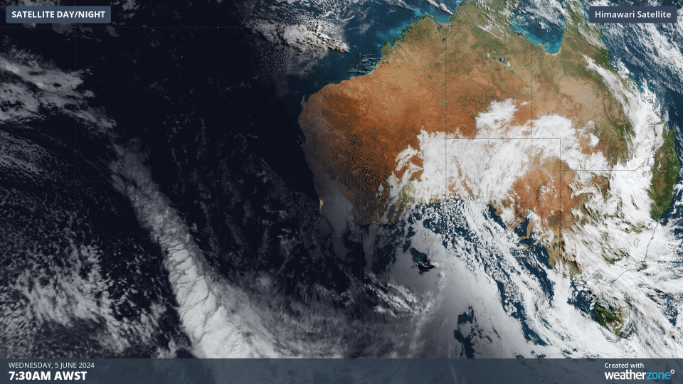
The satellite images below show a cold front passing over the Indian Ocean on Wednesday, approaching Australia from the west. This front will reach the southwest of WA on Thursday and deliver a burst of rain, storms and wind during Thursday and Friday.
Rain and possible storms will initially affect the state’s far southwest from Thursday morning before spreading to Perth and other areas of the South West Land Division in the afternoon and evening. Damaging wind gusts are possible in the state’s southwest with the passage of the front on Thursday.
On Friday, rain will also extend up to the Gascoyne, across the Central Wheatbelt and Goldfields and down to the state’s south coast.
The map below shows how much rain one computer model is predicting between now and the end of Friday.
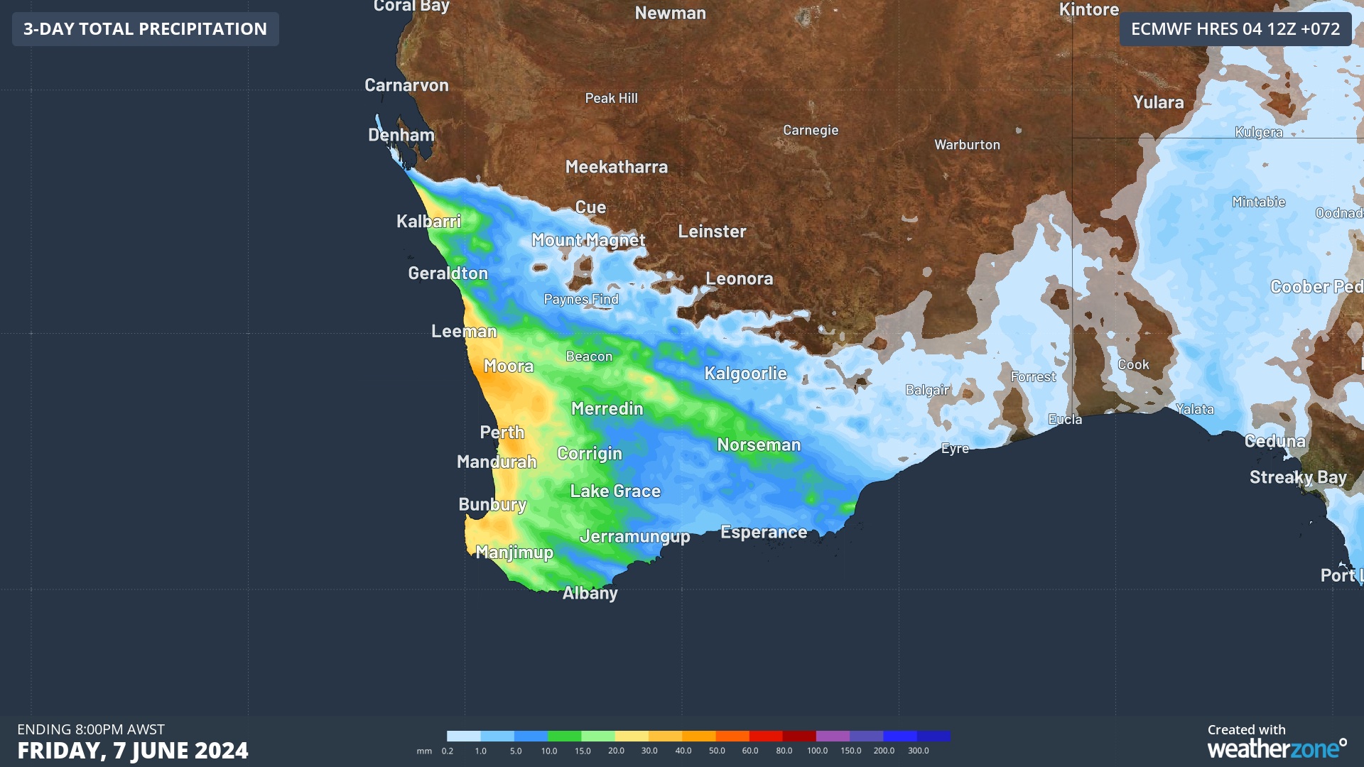
Image: Forecast accumulated rain during the three days ending at 8pm AWST on Friday.
Another front will then approach the state on the weekend, causing rain, storms and wind to reintensify across the west and southwest of WA on Saturday and Sunday.
The heaviest rain on the weekend is expected to fall along the west coast, although useful rain should also extend across parts of the Wheatbelt and southern Goldfields.
Damaging winds are likely to affect some western and southwestern parts of WA on Sunday as a powerful surge of westerlies pushed in behind the cold front. Severe weather warnings are likely to be issued closer to Sunday for this system.
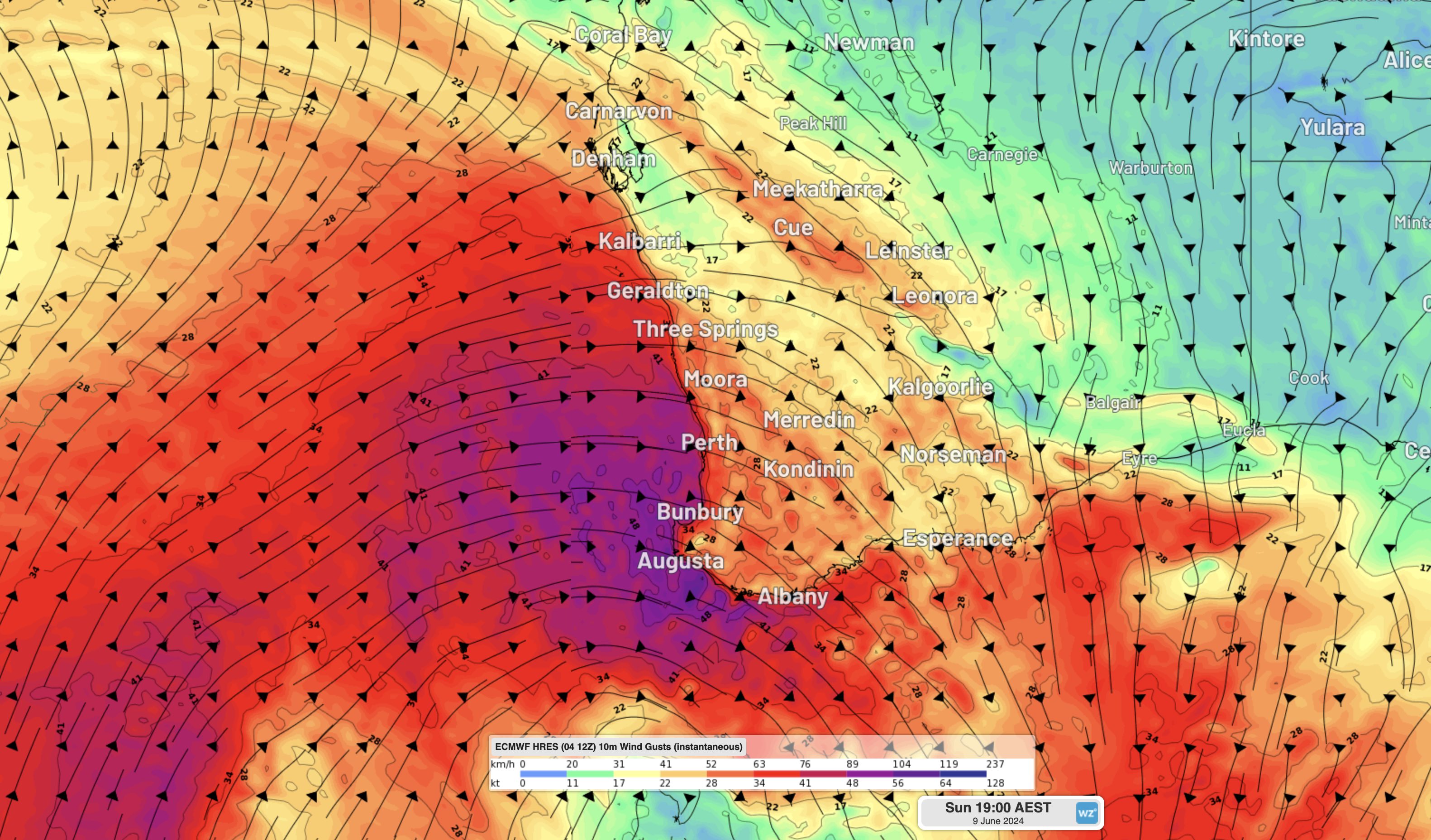
Image: Forecast wind gusts at 5pm AWST on Sunday, according to the ECMWF-HRES model.
Stay up to date with the latest forecasts and warnings during the rest of this week for the most accurate information on these cold fronts.
How can DTN APAC help?
DTN APAC supplies precise weather intelligence to over 75% of the National Energy Market (NEM); and is the trusted provider for the Australian Energy Market Operator (AEMO).
Weatherzone’s next-generation nowcasting and forecasting system, OpticastTM, is independently proven to outperform other industry models, allowing energy traders to respond rapidly to changing conditions. From 14 day forecasting to seasonal outlooks, you have access to complete and powerful weather intelligence giving you the confidence to make the best call.
Meeting the needs of the changing market, Weatherzone utilises high-resolution modelling and local knowledge to provide 5-min granularity observations and forecasts, optimising your market bidding and maximising your profits. These, coupled with briefings from our energy meteorologists, give you full awareness of the associated risk.
Benefit from specialised indices such as apparent temperature, Cooling/Heating Degree Days (CDD/HDD) and Effective Degree Days (EDD) to help accurately predict demand. You can get a clear picture of forecast conditions across the market and quickly assess heat/heatwave potential from 14 days out to 12 months
No matter where your energy trading focus lies, we have the power generation and weather insights to inform your critical decisions, keeping you ahead of the curve. For more information please contact us at apac.sales@dtn.com.


