Prosper in a dynamic world
Search

Finally, rain for SA

A cold front is set to deliver long-awaited rain to SA in the next 48 hours as it swiftly sweeps across the state.  

The image below shows a thick cloud band, with some rain entering the far west of SA on Wednesday afternoon.  

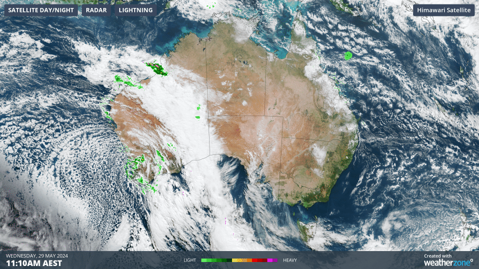
Image: Himawari-9 satellite image at 11:10am AEST on Wednesday, May 29 

This cold front is interacting with tropical moisture which has originated from the Indian Ocean off the Pilbara coast. 

The rain associated with this cold front will begin in the west of the state this afternoon and evening and will move east over the next 48 hours.  

The map below shows one computer model’s rain forecast in the next two days, with widespread falls of 5 to 15 millimetres and isolated areas of 20-50 millimetres particularly in the state’s northeast and parts of the Eyre Peninsula.  

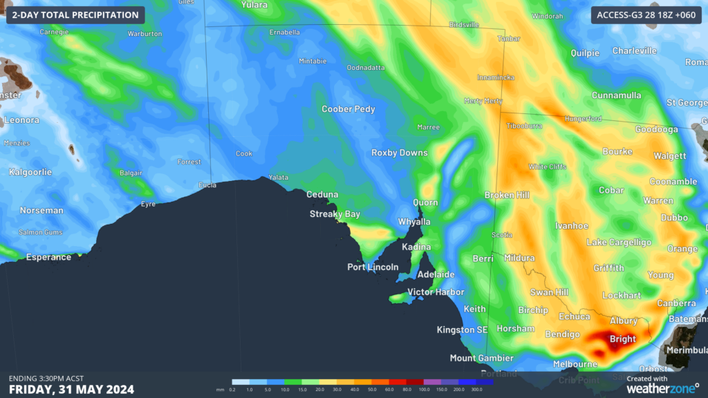
Image: 2-day accumulated rainfall to 3:30pm Friday, May 31, according to Access-G 

This rainband will move quick with most of the rain clearing the east on Thursday night into Friday morning. 

This rain is welcome with large parts of SA seeing a very dry April, which is usually a wet month for the state.  

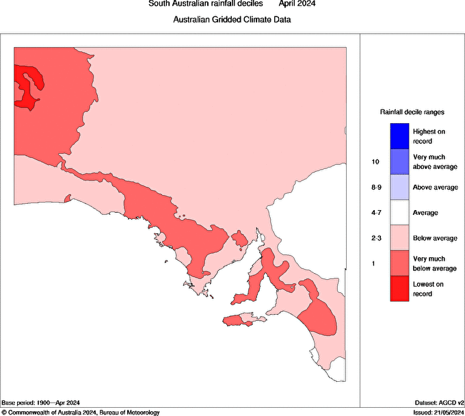
Image: SA rainfall deciles for April 2024. Source: Bureau of Meteorology. 

Some areas in the northwest saw the lowest April rainfall on record, with predominant high pressure forcing rain bearing systems south.  

While the rain band will clear the east of SA by Friday, showers will continue to stream into the south of the state into Saturday before clearing Sunday. 

This cold front will also cause temperatures to plummet on Friday, a day ahead of winter officially beginning. Winds also could reach damaging strength over southern parts of the state in the next 48 hours. Please keep an eye out for the latest warnings here.  


Latest news

Satisfy your weather obsession with these news headlines from around the nation, and the world.

Polar blast brings high energy demand to southeast Australia

A cold front sweeping over southeastern Australia is bringing an icy polar blast and chilly nights. The animation below shows the forecast temperatures at 850 hPa (approximately 1,500 metres up) easily dropping between –2°C to -4°C above the capital cities, which translates to near sea-level surface temperatures in the low-teens. Video: Forecast 850 hPa temperatures over […]

Australia’s highest wind energy generation ever

Wind power generation has reached record levels as a series of powerful cold fronts sweep over Australia’s southeast. Most of Australia’s wind farms are located in South Australia, Victoria and NSW where cold fronts frequently bring periods of high wind energy. Image: wind farm locations across southeastern Australia. A series of powerful cold fronts linked […]

Indonesia’s Lewotobi Laki-Laki volcano eruption disrupting aviation seen from space

Lewotobi Laki-Laki, on the island of Flores, Indonesia, erupted on the afternoon of Tuesday, June 17, sending a large plume of volcanic ash and gases into the atmosphere. Video: Volcanic Ash plume visible on satellite imagery on the morning of Wednesday, June 18, 2025. Lewotobi Laki-Laki and Perempuan The Lewotobi twin volcano is located on […]

How wind energy has changed Australia’s energy sector

An increasingly reliable and resilient Australian renewable energy network depends on varied and vast sources of energy and accurate and informative forecasting, to meet the increasing energy demand. The main criticism in the transition to renewable power supplies has come from the dependence on weather and climate to maintain a steady production to meet the […]