Prosper in a dynamic world
Search

A great week for solar

Much of Australia will not see a drop of rainfall this week, with clear skies expected to increase solar output.

The satellite image below shows much of Australia basking in Autumnal sunshine on Monday morning. 

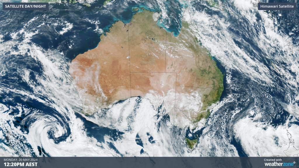
Image: Himawari-9 satellite image at 12:20pm AEST on Monday, May 20 

The relatively dry week comes as a stubborn high-pressure system parks itself over southern Australia for the week. 

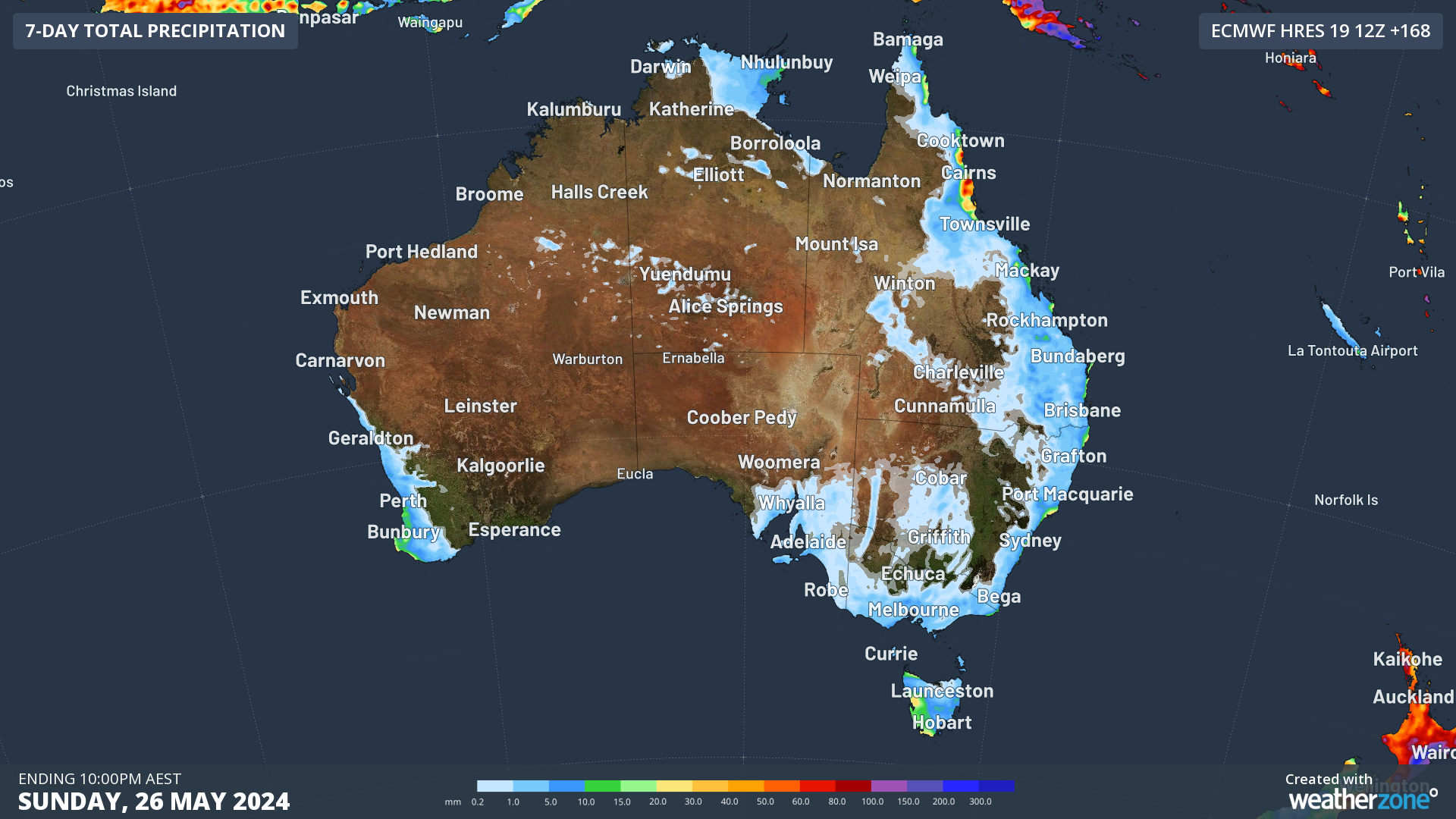
The map below shows the forecast rainfall over the next 7 days. While most of Australia is expected to see a dry week, the largest totals will fall in Far North Qld, western Tas, parts of NSW, and southwest WA. 

Image: Accumulated rainfall forecast to 10pm on Sunday, May 26, according to ECMWF 

A cold front will sweep across Tas on Thursday, bringing showers to the state. Meanwhile, another cold front is approaching southwestern WA, which will bring showers and thunderstorms on Friday as it crosses.  

Far North Qld will see the largest daily totals from mid to late week as a southeasterly airstream strengthens and feeds moisture into the region. The south-facing coastline around central and northern NSW should also see showers stream in on Tuesday, before easing later in the week. At this stage, the good news is that the week should be free of severe weather. 

Weatherzone Business and Solcast are a market-leading partnership delivering highly specialised solar data to the Australian renewable energy industry. For more information, please contact us at apac.sales@dtn.com.   


Latest news

Satisfy your weather obsession with these news headlines from around the nation, and the world.

Rapid El Niño signal accelerating risk for Australian businesses

El Niño–favourable conditions are gathering pace across the tropical Pacific, with key ocean indicators approaching threshold levels and early atmospheric responses emerging.  While uncertainty remains around final El Niño strength, historical analogues show that even weak events can generate widespread impacts, including reduced rainfall, warmer daytime temperatures, increased frost risk, elevated fire danger, reduced tropical cyclone activity, and more. Industries including […]

Australia’s 2025–26 Cyclone Season: Slightly Above Average, Dominated by Severe Systems

Australia has just experienced a highly impactful tropical cyclone season, with more than 60% of systems reaching severe intensity, causing widespread disruption and damage to communities and multiple industries across northern Australia.  The 2025–26 Australian tropical cyclone season officially ran from 1 November 2025 to 30 April 2026. During this six-month period, Australia saw 11 tropical cyclones, with nine […]

What does a ‘super El Niño’ mean for Australia’s businesses?

There are signs that a very strong, or ‘super’ El Niño could develop in the tropical Pacific Ocean later this year. So, what does this mean for Australia’s weather during the second half of 2026? El Niño on the horizon The tropical Pacific Ocean is currently in a neutral state, meaning neither El Niño nor […]

How does DTN help businesses monitor bushfire induced pyrocumulonimbus thunderstorms that ignite more fires?

Intense heat from bushfires during elevated fire danger days can trigger fire-induced pyrocumulonimbus thunderstorms that ignite additional fires. In early January 2026, an extreme heatwave sweeping over southeastern Australia brought catastrophic fire danger to Victoria. Intensely hot bush and grass fires spread erratically and quickly in hot, dry and gusty winds, with pyrocumulonimbus generating lightning, […]