The mild autumnal weather that southeastern Australia has been basking in this week is about to come to an abrupt and chilly end, with snow possible down to 600 metres in Tas.
A strong cold front will cause the huge contrast in temperatures and is expected to sweep across southeastern Australia on Friday and into the weekend.
The cold front will drag a frigid airmass over the region late this week, dropping temperatures to 3-5°C below average and bringing subzero overnight temperatures to some areas. The wintry blast will reach Melbourne on Friday afternoon and Sydney later that night.
The image below shows forecast air temperatures around 1.5km above sea level on Friday, revealing how warm autumn-like air in the middle of the week will be replaced with a much colder wintry air mass by Friday.
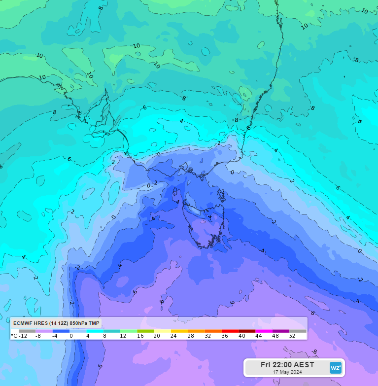
Images: Forecast 850 hPa temperature at 10pm AEST on Friday, May 17, according to the ECMWF-HRES model.
The southeastern capital cities will see both maximum and minimum temperatures plummet from Friday, with the following temperatures forecast:
- Hobart’s maximum will be 12-14°C on the weekend, which is 2-3°C below May’s average
- Melbourne’s daytime temperature will struggle to reach 14°C on Saturday and the minimum temperature early on Sunday morning should drop to 7°C.
- Adelaide’s overnight temperature Saturday into Sunday will drop to 5-6°C, which is around 4-5°C below the May average. The city should also see a run of 4 days from Saturday with the maximum reaching only 17-18 °C
- Canberra will be freezing Sunday morning, with frost and a minimum of –1°C, the daytime temperature will reach only 13°C on Saturday
- Sydney is also in for a cool weekend with daytime temperatures of 17-19°C, nighttime temperatures will drop to 7-9°C.
- Brisbane’s minimum will drop to 11-12°C early Sunday and Monday mornings, which is 3-4°C degrees below May’s average.
These cool temperatures could feel up to 5°C cooler with strong southerly winds adding to the windchill.
These winds should increase wind power across the southeast over the weekend, after a lengthy period of lighter winds in recent months.
The wintry blast will also drop the snow level over the southern alpine regions, with the snow level expected to drop down to 600 metres in Tas.

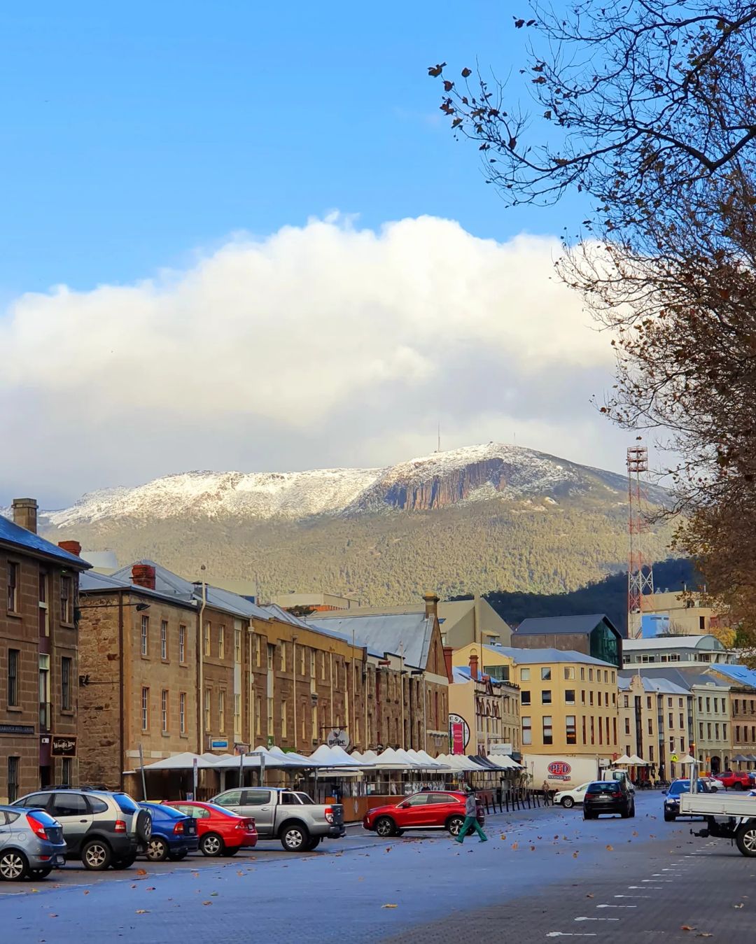
Image: Snow on Mount Wellington, Tas on May,17 2022 Source: @jrikin
The Vic alps could also see snow down to 1400 metres, and while the NSW alps could see a dusting, it doesn’t look like much will fall over the region at this stage.
Weatherzone Business has grown to become the outright leader within the Australian energy market, serving wind, solar, hydro, trading, utilities and network companies.
You can’t control the weather, but you can gain precision insights to optimise your response. What lights us up is providing your energy business with tailored weather information to reduce your risk and keep you moving ahead of the curve.
Our services cover all aspects – from wind and solar generation to demand forecasts, wholesale markets to retail so, no matter where your company sits, we have solutions for you. We have worked closely with market participants to create products that meet the evolving needs of the sector, aiming to increase safety and profitability for our customers.
Benefit from the timely delivery of accurate weather information, allowing informed and effective decision-making. Contact us here.


