
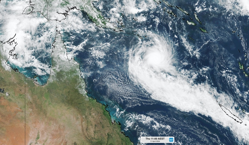
Tropical Cyclone Paul has formed over the northeast Coral Sea and could reach category three intensity by Thursday afternoon.
Paul formed in the early hours of Thursday morning, becoming the 8th tropical cyclone in the Australian region so far this season.
On Wednesday, Bureau of Meteorology outlooks only suggested a low chance of tropical cyclone development in the Coral Sea this week, However, a moderately favourable environment with warm sea surface temperatures around 30ºC allowed Paul to form in the early hours of Thursday morning.
Despite being restricted by some vertical wind shear, Paul has been able to gain strength on Thursday morning. After forming around 4:00 am AEST on Thursday, Tropical Cyclone Paul had reached category two intensity by 10:00 am and could surge to category three by Thursday night.

Image: Composite infrared/visible satellite image showing Tropical Cyclone Paul on Thursday morning.
Fortunately, Paul is located more than 1000 km to the east northeast of Cairns and currently poses no direct threat to the Australian mainland or any of its external territories.
Paul is expected to remain slow-moving over the northeast Coral Sea during the remainder of Thursday and on Friday, before tracking towards the west northwest on the weekend. At this stage, Tropical Cyclone Paul should weaken from Friday onwards and is expected to have wakened below tropical cyclone strength by Saturday.
Based on current model guidance, Tropical Cyclone Paul is not expected to move near the Australian mainland as a tropical cyclone.
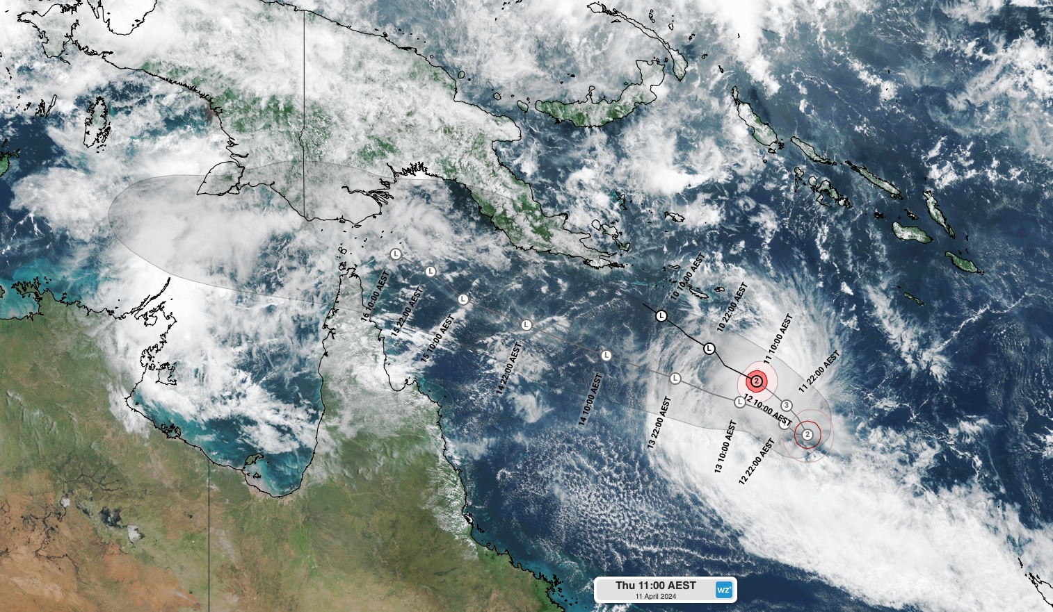
Image: Visible satellite image and Bureau of Meteorology forecast track map for Tropical Cyclone Paul, valid at 11:00am AEST on Thursday, April 11.
Meanwhile, the remnants of Tropical Cyclone Olga will bring rain and some thunderstorms to some northwestern, central and southern parts of WA over the next 72 hours. This system has the potential to cause heavy falls in the Pilbara and Gascoyne, although the state’s parched southwest will miss out on any wet weather.
Another area of low pressure is expected to form over the Arafura Sea to the north of the NT’s Top End this weekend. If this low pressure system does form, there is a low chance it could mature into a tropical cyclone from Sunday into next week.
The next tropical cyclone to form inside the Australian region will be named Robyn.
DTN APAC, specialises in industry-leading forecast, alerting and threat analysis of tropical cyclones, offering you expert, customised solutions when the weather turns wild.
Providing rapid-update forecast information, we alert you to any low-pressure system gaining power within your region and, unlike other providers, can track its development out to 7 days. This gives you the time to prepare and safeguard your staff, sites and assets.
You will have the most precise weather intelligence charting rainfall, wind speeds and potential storm surges to help you make critical decisions quickly. Whether it’s adjusting key work schedules, protecting your staff or securing your site, we have the alerting capability to keep you steps ahead of the storm.
We will support you, 24/7, keeping you informed and making your critical decisions easier. For more information, please contact us at apac.sales@dtn.com.




