As Perth and the southwest corner of Western Australia emerge from their traditional spring, summer, and early autumn dry season, the wait for decent rain is a lot more frustrating than usual.
There are two reasons for the heightened stress levels. The first is that even by local standards, it has been an exceptionally very dry period.
- Indeed, Perth is facing the strong likelihood of its driest six-month period in 148 years of records dating back to 1876.
- Previously, the driest six-month stretch from October through to the end of March was 37 mm in 1994/95.
- But since the start of October 2023 to this Friday, March 22, there has been just 22 mm.
Can the city find another 15 mm by the end of the month to avoid the six-month record? Unfortunately, the short-range and medium-range forecasts suggest that’s unlikely.
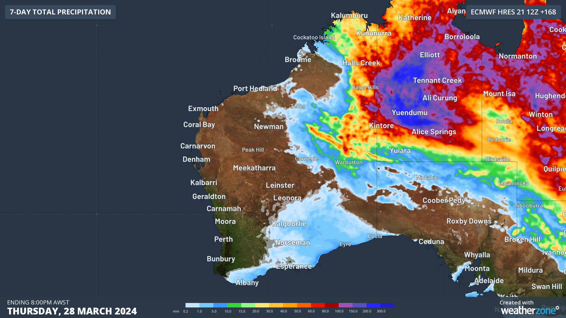
Image: The forecast rain for the seven days leading up to March 28 shows nothing for Perth.
The second main reason why locals in Perth and nearby areas are feeling the lack of rain so acutely right now is that heavy rain has fallen in traditionally dry parts of the state.
- As most people would be aware, the Nullarbor recently flooded, with some truly remarkable rain totals.
- For example Eyre – a weather station at a bird observatory about 300 km west of the South Australian border on the rugged coastline of the Great Australian Bight – has received a whopping 349.4 mm to date this month, exceeding its annual average rainfall of 315.9 mm within just four days.
- Even Kalgoorlie in the state’s parched Goldfields district has had eight rain days with 1 mm or more of rain to date in March, including a day when 50.2 mm fell. Typically, Kalgoorlie sees just 2.8 days with 1 mm or more in March.
The map below shows rain that fell across Australia in the week to Thursday March 21. In many ways it’s a week which was typical of recent times: rain in all sorts of places, but nothing for Perth and most of the southwest.
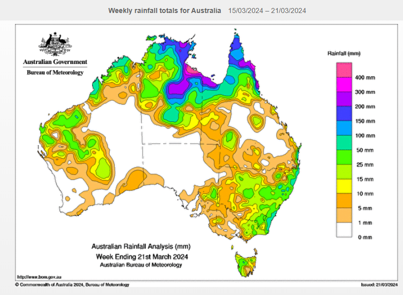
Image: Another week when the despised Perth rain shield did its job. Source: BoM.
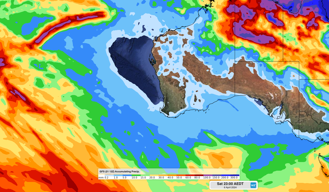
Unfortunately there are no strong signs of significant rainfall in the next two weeks for southwest WA.
For more information on our seasonal forecasts, please contact us at apac.sales@dtn.com.


