A tropical low to the northwest of WA is moving towards the Pilbara and could develop into a tropical cyclone over the weekend. But will it cross the coast?
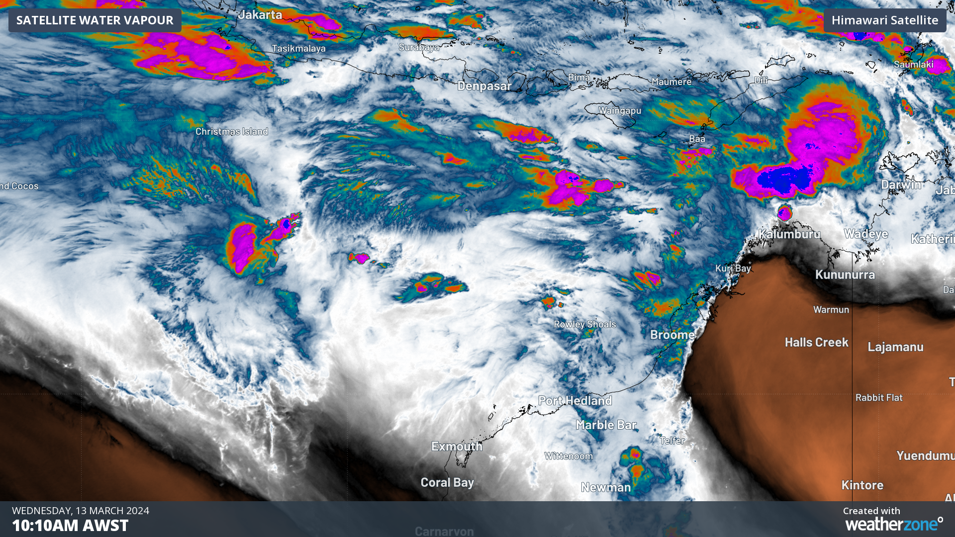
The tropical low designated 08U was southeast of Christmas Island on Wednesday morning. The system is expected to develop into a tropical cyclone on Friday as it moves further east into more favourable ocean and atmospheric conditions.
There is still a large amount of uncertainty in the movement of this system towards the end of this week, with some models forecasting the cyclone will remain offshore while others have it crossing the Pilbara coast.
The map below shows four different computer models’ forecast positions for the tropical cyclone or tropical low on Sunday night.
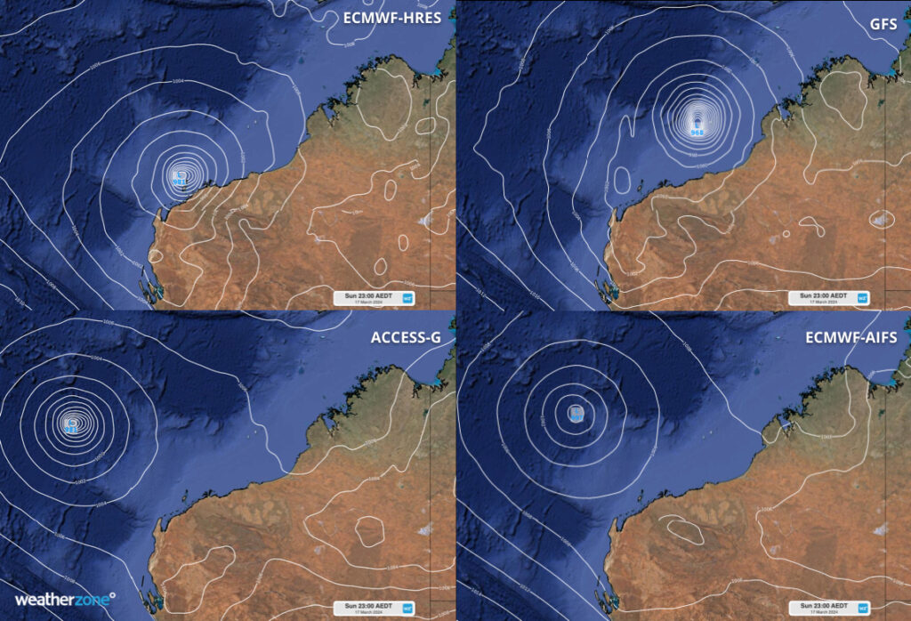
Image: Mean Sea Level Pressure (MSLP) forecast for 8pm AWST on Sunday, March 17, according to the ECMWF-HRES (top left), GFS (top right), Access-G (bottom left) and ECMWF-AIFS (bottom right) models
One of the computer models shown above has the system crossing the Pilbara coast on Sunday or Monday, while another brings the cyclone close to the shore, and the other two computer models keep the cyclone well offshore.
The strength of the winds and other weather impacts along the Pilbara coast will greatly depend on how close the system passes to the WA coastline, but most models agree that we could see the impacts from this system over the weekend.
The map below shows the Bureau’s forecast is for the cyclone to remain offshore and move to the southwest from Saturday, March 16.
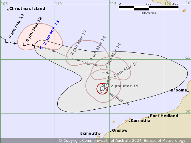
Image: Forecast track map issued by the Bureau of Meteorology Issued at 2:32am AWST Wednesday 13 March 2024. A more recent track map may be available. Source: Bureau of Meteorology
The Bureau is forecasting the system to come close to the Pilbara coast but then moving parallel to it and stay offshore, possibly indirectly impacting the coast but not crossing it.
While this is their most likely scenario, there is still a risk of the cyclone impacting the Pilbara coast later this week or early next week, so please keep an eye out for the latest warnings and advisories.
To the north of the country, another tropical low designated 09U is expected to strengthen in the Timor Sea and cross the Top End, NT in the next 48 hours. On Saturday, the low should move into the Gulf of Carpentaria and has a moderate risk of developing into a tropical cyclone over the warm waters.
Another low 10U is expected to form near Far North Queensland and move into the Coral Sea, where it has a low risk of developing into a tropical cyclone between Thursday to Saturday. This system will remain well offshore the QLD coast. For more information on our tropical cyclone services, please contact us at apac.sales@dtn.com.


