
Perth just had its second hottest summer on record based on daytime temperatures, capping off the season with a remarkably warm February featuring a record-breaking number of 40°C days.
The average maximum temperature in Perth this summer was 32.6ºC. This is roughly 1.7°C above the long-term average and the city’s 2nd highest summer maximum temperature in records dating back to 1897.
The only summer with a higher average maximum temperature than this season was the absurdly high 33.3°C in 2021-22, which was a whopping 2.5ºC above average and beat the previous record by a whole degree.
This summer’s mean summer temperature in Perth came in at 25.6°C, which is about 1.3°C above average and the city’s third highest summer mean temperature on record.
There wasn’t much rain to speak of in Perth this summer, mainly because rain isn’t a frequent sight in southwestern Australia during the summer months. Indeed, Perth only picked up 6.8 mm during the whole season, which fell across five days. But despite failing to crack into double figures for rainfall, this was still the Perth’s wettest summer in 3 years.
One of the standouts stories from this summer in Perth was the unusually high frequency of 40ºC days towards the end of the season.
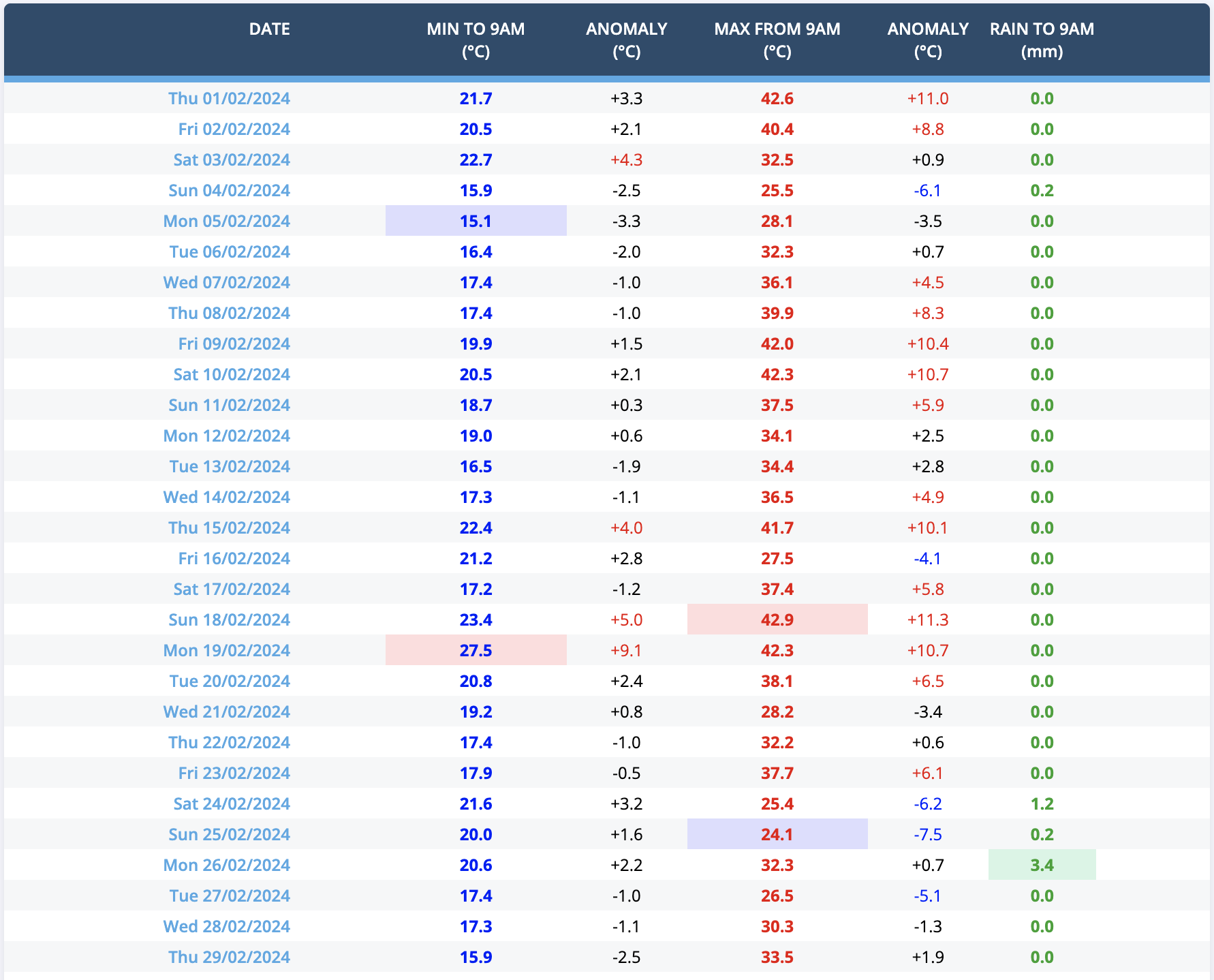
Image: Daily minimum and maximum temperature and rainfall observations for Perth in February, 2024.
Perth’s Metro weather station registered seven days above 40ºC during February, breaking the record for the most days at or above 40ºC in a single calendar month. The previous record in Perth was six 40ºC days from January 2022.
While this summer’s total of eight 40ºC days is up there with the most ever observed for Perth, it doesn’t rival the 13 days at or above 40ºC recorded during the 2021-22 summer.
DTN APAC can provide solutions for your business to alert you of the most likely weather conditions and hazards to look out for during the upcoming season. Now is a good time to get a good look at the forecast for autumn and a look deeper into 2024. To find out more please email apac.sales@dtn.com.


