
Parts of central and western Victoria have just endured their driest February in more than 30 years, priming the landscape for extreme to catastrophic fire danger this Wednesday.
While December and January were abnormally wet for most of Vic, the tap has been turned off for the western half of the state during February.
The map below shows how much rainfall has been observed across the state so far this month as a percentage of the February’s long-term average. The brown shading over the western half the state represents areas that have seen less than 20 percent of their typical monthly rainfall this February.
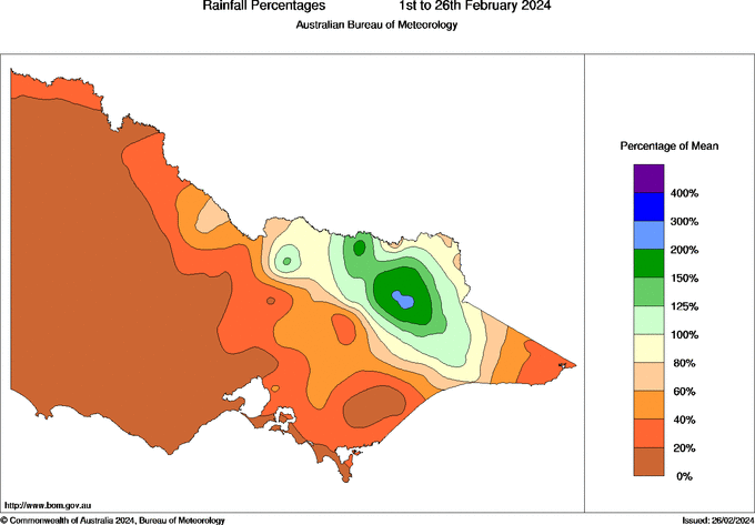
Image: Rainfall percentages for the first 26 days of February, showing how the current month-to-date rainfall compares to the long-term February average. Source: Bureau of Meteorology
Rain gauges stretching from Melbourne up to Mildura have received barely any rain this month, with this dry weather also coinciding with extreme heat at times. Some of the standout running monthly rainfall totals as to 9am AEDT on Monday, February 26, included:
- 1.4 mm at Melbourne Airport, on track to be its driest calendar month since 1991 and second driest February on record
- 0 mm at Stawell, on track to be their driest February since 1991
- 1.6 mm at Portland Airport, also its driest February since 1991
- 2.6 mm at Bendigo, likely to be its driest February since 2009
This exceptionally dry February in western and central Vic has come as a stark contrast to the run of abnormally wet weather in the previous two months. While Stawell has seen 0 mm so far this month, it had 86 mm in January and 78 mm in December, which were both more than double the monthly averages for the respective months.
This rapid transition from wet to dry weather has allowed the vegetation that grew abundantly in December and January to dry out during February, boosting fuel loads for fires.
The frequent fires that have scorched the landscape in the last couple of weeks have showcased the impact of this month’s lacklustre rainfall in central and western Vic.
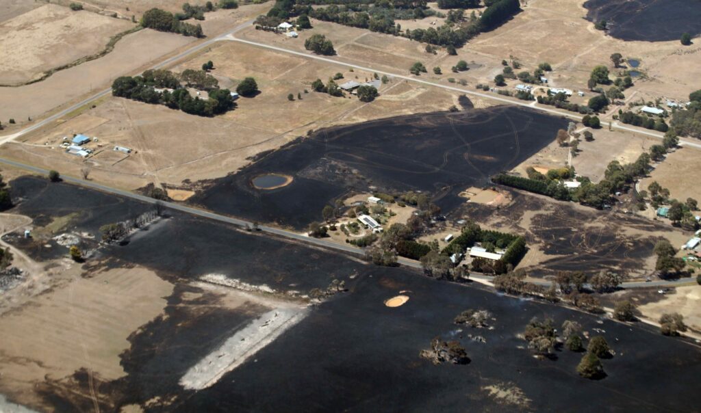
Image: A dry landscape showing land burnt by fires near Beaufort, Vic on Saturday, February 24, 2024. Source: AAP Image
Unfortunately, another burst of hot, dry and windy weather will sweep over Vic in the middle of this week, causing fire danger ratings to spike in the state’s parched western half.
Catastrophic fire danger has been forecast for the Wimmera on Wednesday, while Extreme ratings are likely for the rest of central and western Vic, in eastern SA and southwest NSW.
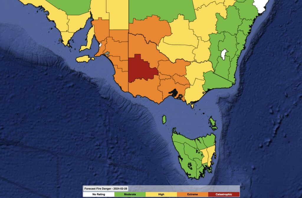
Image: Forecast fire danger ratings on Wednesday, February 28, 2024.
You can check the latest fire information in each state here:


