Ex-Tropical cyclone Lincoln is likely to re-develop into a cyclone by Friday morning, before it sets its path towards the Pilbara or Gascoyne coasts on the weekend.
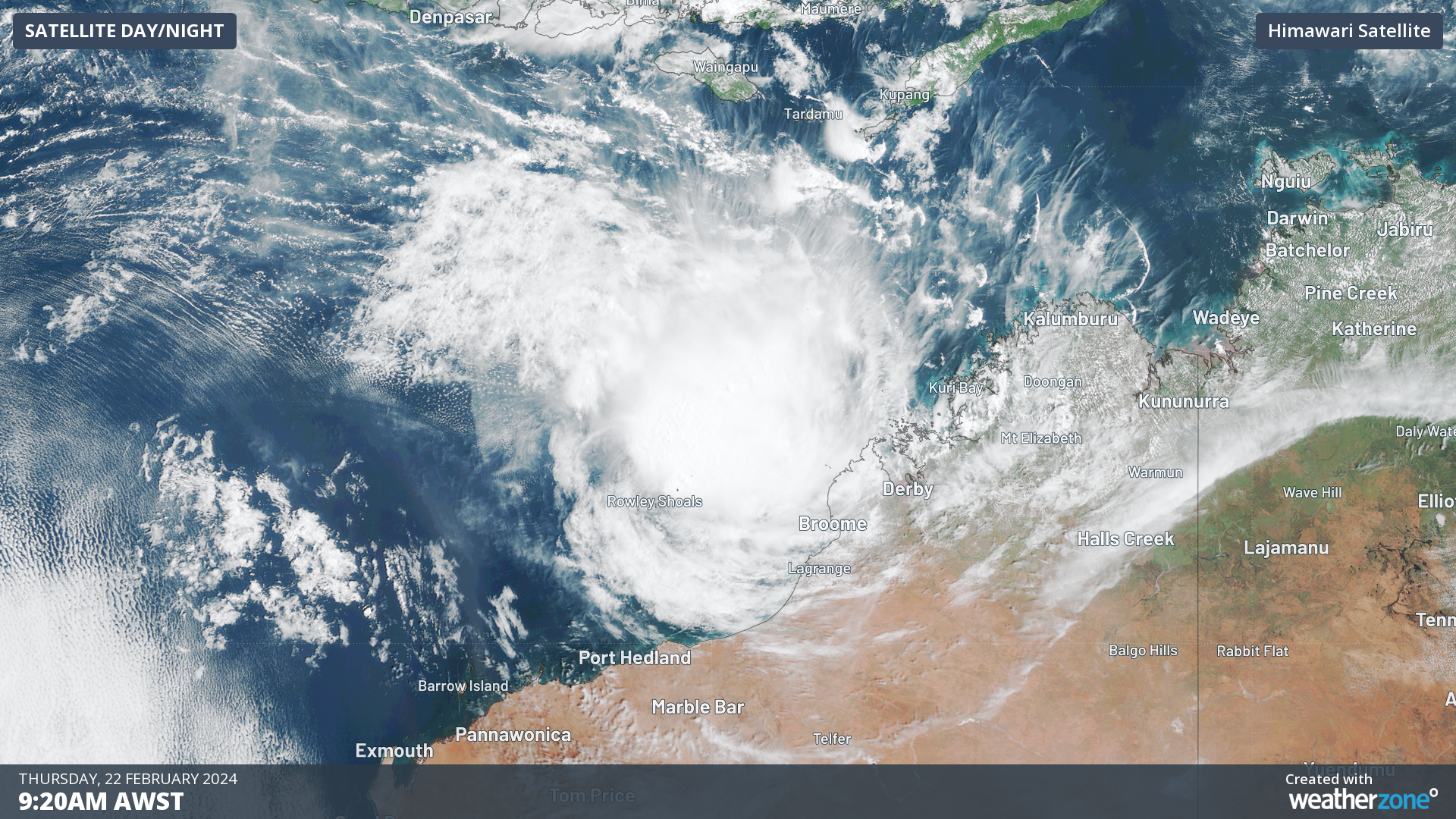
The image below shows clouds rotating around ex- tropical cyclone Lincoln on Thursday morning when the system was around 270 km northwest of Broome.
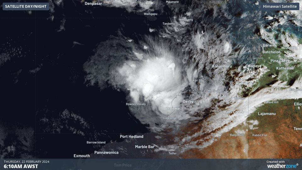
Image: Himawari-9 satellite imagery for the three hours leading up to 9:20am AWST on Thursday, February 22.
The imagery above shows the tropical low gaining strength over the warm waters of the Kimberley coast on Thursday.
The system will turn towards the southwest and move closer to the Pilbara coast on Friday, moving into favorable environmental conditions that should allow it to redevelop into a Tropical Cyclone.
The track map from the Bureau of Meteorology shows that the cyclone could impact the west Pilbara or northern Gascoyne coast on Friday and Saturday, possibly as a category two system.
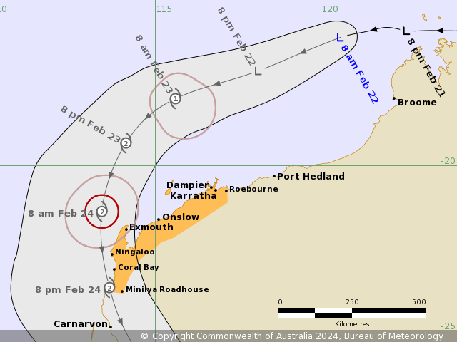
Image: Forecast track map issued by the Bureau of Meteorology at 8:55 am AWST on Thursday, February 22. A more recent track map may be available. Source: Bureau of Meteorology
The impacts of this cyclone could be felt as early as Friday morning between Roebourne and Cape Preston, with gales and damaging winds gusts forecast.
The fierce winds will extend further inland on Friday evening into Saturday as the system moves south and then southeast. Near the cyclone’s core, destructive wind gusts are possible on Saturday. The cyclone is also likely to cause very rough seas, which could cause flooding in some low-lying coastal areas.
Lincoln is a fast-moving system, which means heavy rainfall may not be widespread as it approaches and crosses the coast. However, heavy falls will still occur along the cyclone’s track and could extend over inland parts of the Gascoyne, Central West and Central Wheatbelt Districts as it moves further inland while weakening.
The images below shows that widespread falls of 50-100mm are forecast across the southern Pilbara, Gascoyne, Central West and Central Wheatbelt districts by several forecast models. Lincoln could dump 100-200mm in its path with the possibility of some areas receiving falls above 200mm.
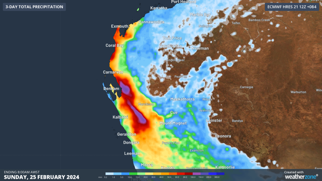
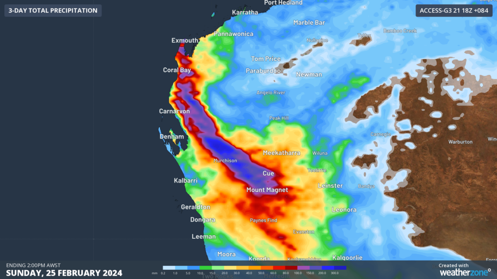
Image: 72-hour accumulated rainfall to 8am WST (ECMWF top) and 2pm WST (ACCESS bottom) on Sunday, February 25
As you can see above, there is some uncertainty around where and how much rainfall will fall, as it will greatly depend on the cyclone’s track.
Please keep abreast of the latest warnings and track maps as this system unfolds.
DTN APAC, specialises in industry-leading forecast, alerting and threat analysis of tropical cyclones, offering you expert, customised solutions when the weather turns wild.
Providing rapid-update forecast information, we alert you to any low-pressure system gaining power within your region and, unlike other providers, can track its development out to 7 days. This gives you the time to prepare and safeguard your staff, sites and assets.
You will have the most precise weather intelligence charting rainfall, wind speeds and potential storm surges to help you make critical decisions quickly. Whether it’s adjusting key work schedules, protecting your staff or securing your site, we have the alerting capability to keep you steps ahead of the storm.
We will support you, 24/7, keeping you informed and making your critical decisions easier. For more information, please contact us at apac.sales@dtn.com.


