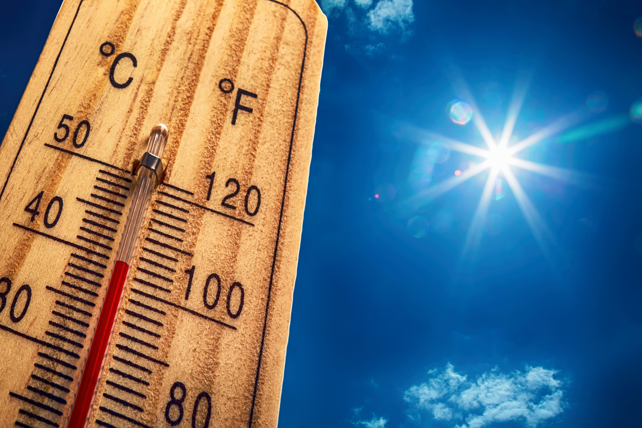
Perth just recorded its 7th day above 40°C this month, after registering the warmest night in 10 years.
The warm minimums came after a searing hot day on Sunday, with Carnarvon Airport recording the highest temperature in the world so far in 2024 and the hottest temperature the town had seen since records began in 1883.
The map below shows thick cloud travelling thousands of kilometres across to southwestern WA from Tropical Cyclone Djoungou in the Indian Ocean.
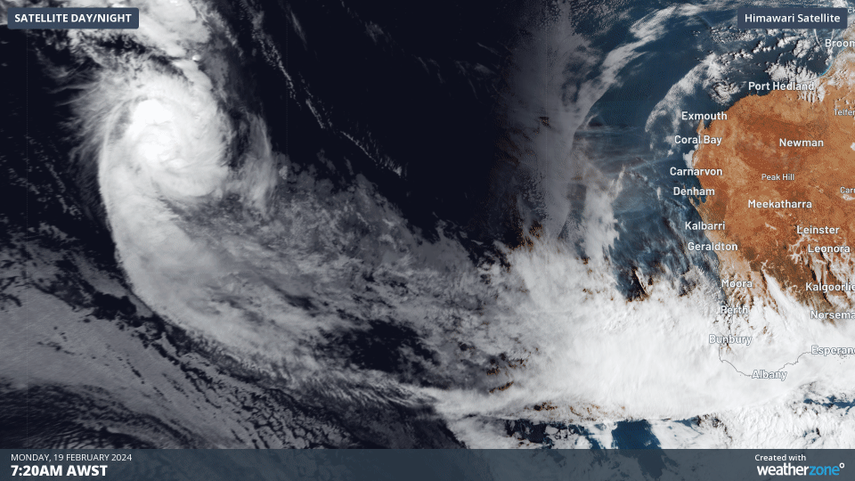
Image: Himawari-9 satellite image for the three hours leading up to 9:30am AWST on Monday, February 19.
This cloud acted as a blanket overnight trapping in Sunday’s warmth, bringing one of the warmest nights in years.
Minimum temperatures across parts of WA’s central and southern coast remained in the high 20’s and low 30’s on Sunday night into Monday morning.
Perth had its warmest night in 10 years and the warmest February night in 20 years, with a minimum temperature of 27.5°C recorded at 5am on Monday, February 19.
Some other notable February minimums from Perth and surrounds were;
- Perth Airport had its warmest February night in 20 years, with the temperature failing to drop below 27.7°C
- Jandakot recorded the warmest February minimum in 27 years, with an overnight temperature of 28°C
To the north of Perth, Badgingarra saw the warmest night in 43 years, with a sweltering hot minimum temperature of 30.3°C.
The southwest of WA also saw some incredible minimum temperatures, with Busselton Airport (26.7°C) recording its warmest night since records began 67 years ago. Bunbury (27.2°C) and Cape Naturaliste (26.3°C) saw the highest minimum temperature recorded in 54 and 35 years respectively.
After a warm beginning to Monday, daytime temperatures are expected to reach the mid 40’s in many areas of the state.
Perth’s temperature hit 40.2ºC at 12:30pm AWST on Monday, February 19, making today the 7th day over 40°C this month. This is the highest number of 40ºC days ever recorded in an individual calendar month in Perth. While there is a small chance of an 8th day over 40ºC on Tuesday, the temperature will probably peak closer to 39°C.
The extreme heat on Monday and Tuesday will combine with strong and gusty northwesterly winds and an afternoon seabreeze, generating extreme fire danger.
The maps below show that extreme fire danger is forecast across the central and southern coastal districts on Monday and southwestern WA on Tuesday.
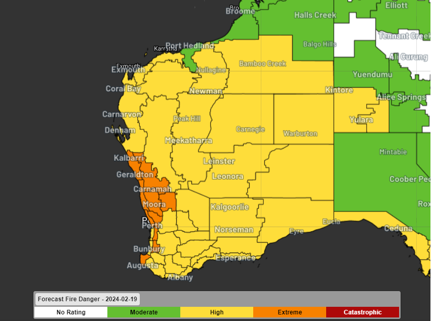
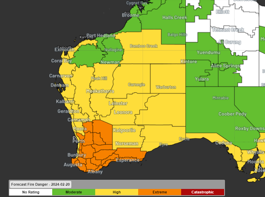
Image: Forecast fire danger for Monday (Top) February 19 and Tuesday (bottom)
Looking ahead, a cold front is expected to drop the temperature on Wednesday, before another burst of heat expected later in the week. For more information on Weatherzone’s temperature forecasts
Independently verified to significantly outperform other industry models, Opticast gives you a strategic advantage if weather impacts your enterprise. Armed with the most accurate nowcasting and forecasting data, you can mitigate operational and safety risks, and plan to make the most of severe weather windows.
Opticast is powered by machine learning, intelligently adapting to the local conditions of your site area. Gain a world-leading forecasting system that rapidly responds to changing conditions.
We give you the foresight to make quick and powerful decisions when you need to protect your valuable team and assets, and ensure maximum productivity. For more information, please contact us at apac.sales@dtn.com.


