Temperatures reached close to 50 degrees over parts of WA’s Gascoyne and Central West, setting new town records over the region, and ranking in some of Australia’s hottest temperatures ever recorded.
The Gascoyne region of Western Australia spans over 135,000 square kilometres (about double that of Tasmania), yet only has a total of 6 weather stations monitoring conditions across the region. Two of these stations managed to get within 0.2°C of the scorching 50-degree mark, setting station records, and ranking in some of Australia’s hottest temperatures ever recorded.
The 49.9°C recorded at Carnarvon Airport is:
- Hottest location in Australia today (Sunday 18th) and for this summer.
- 2nd hottest February temperature ever recorded in Australia.
- Tied 8th hottest temperature ever recorded in Australia (any month).
- Hottest day ever recorded at the town, with records dating back to 1883.
- The highest temperature recorded in the world so far in 2024.
Some 100 kilometres to the south, Shark Bay Airport, which services the town of Denham, reached a maximum temperature of 49.8°C, making it tied 3rd hottest February maximum ever recorded, and again, a station record.
And, while not in the Gascoyne district, the town of Geraldton in WA’s Central West was the third location in Australia on Sunday 18th to reach the 49-degree mark, with temperatures peaking at 49.3°C. This is the third time this month that Geraldton Airport has reached above 46 degrees, and makes it the hottest day on record for the town, with records dating back to 1877.
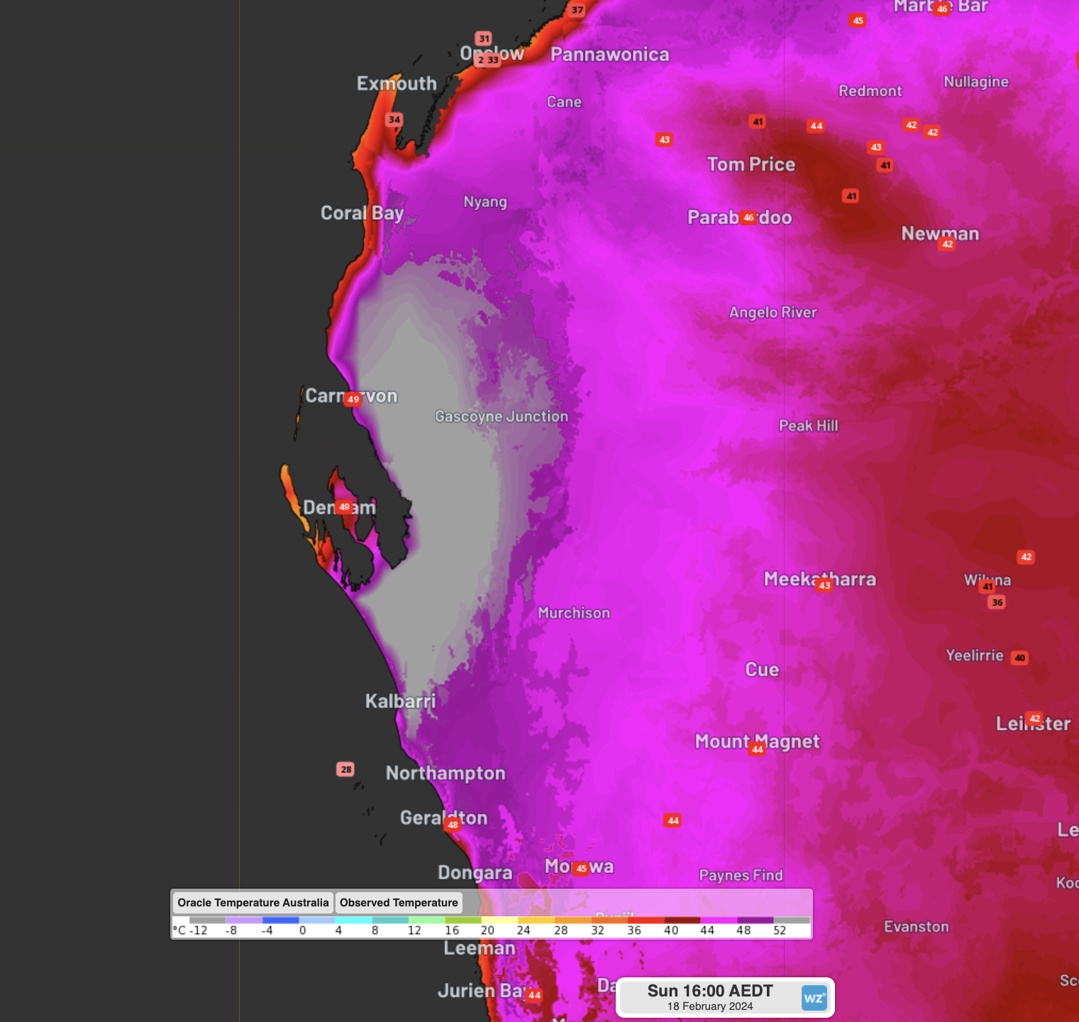
Observed temperatures at 1pm AWST with overlaid Oracle model temperatures over the region.
Further to the south, Perth registered another 40-degree day (with a maximum of 41.7°C), marking the 6th day above 40°C this month. With another day of heat forecast tomorrow, Perth is expected to break its record for most 40°C days in one month. Severe-to-extreme heatwave conditions will keep a hold over much of the state into the coming days, before easing into the latter half of the week.
Your business can benefit from the timely delivery of accurate weather information, allowing informed and effective decision-making. For more information, please contact us at apac.sales@dtn.com.


