
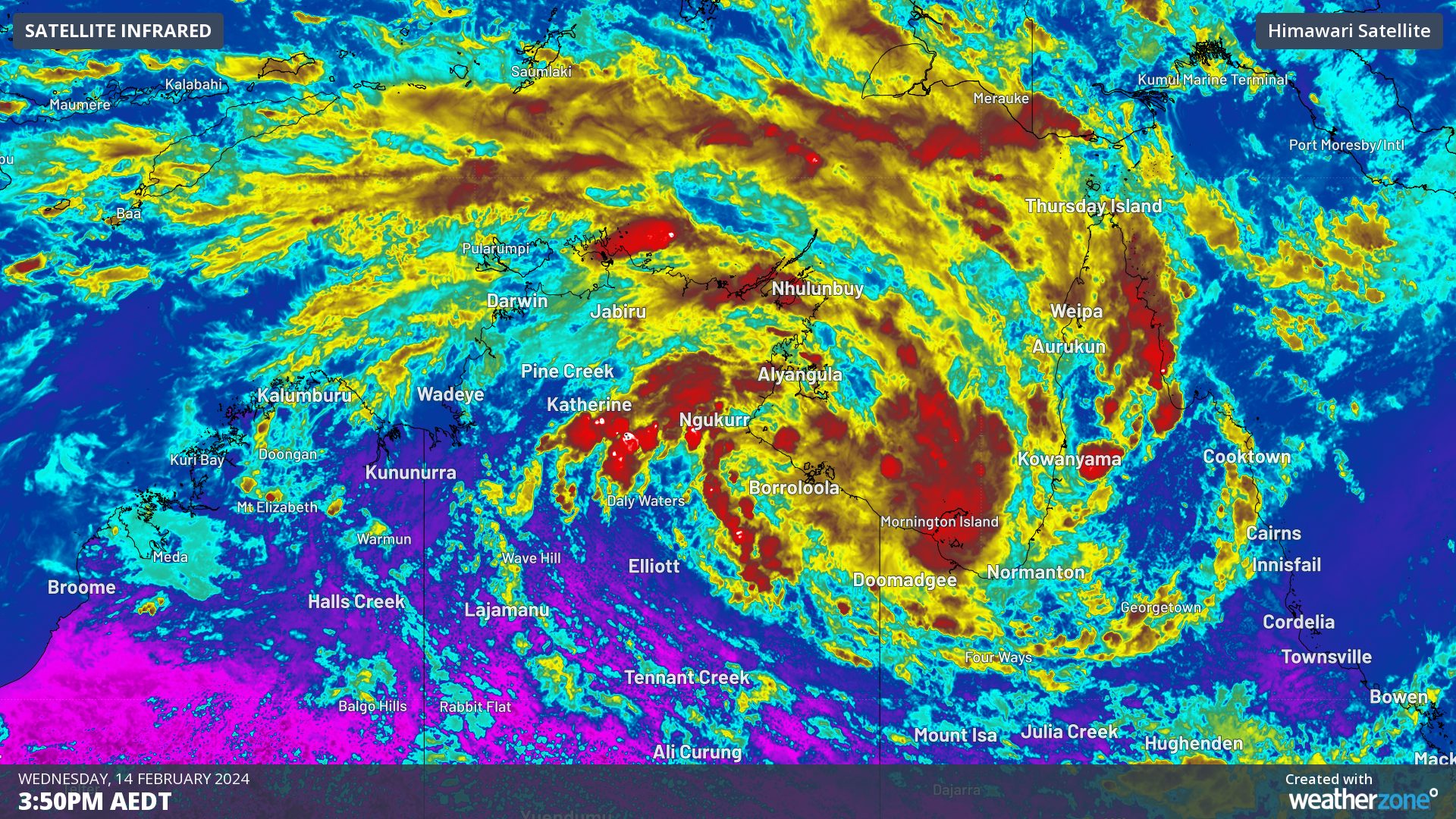
A tropical low (07U) has now formed over the Gulf of Carpentaria, with a moderate chance of becoming a tropical cyclone on Thursday or Friday.
The satellite image below shows a broad-scale circulation rotating clockwise around the tropical low on Wednesday morning.
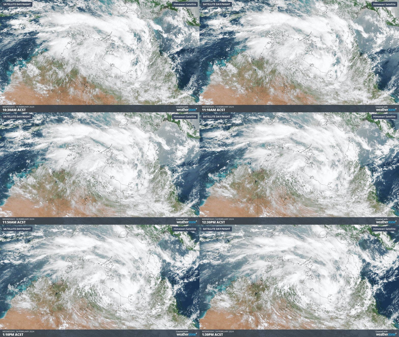
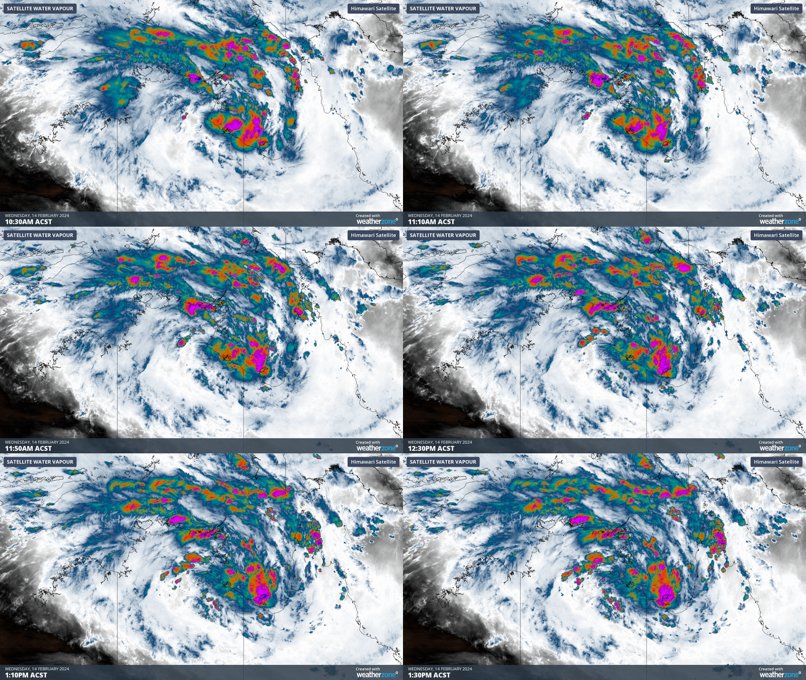
Image: Himawari-9 visible (top) shows the system rotating and the water vapour image (bottom) shows the system growing on Wednesday, February 14.
The system should strengthen further as it moves slowly over the Gulf of Carpentaria during the next 48 hours, with warmer than normal sea surface temperatures feeding moisture into the low.
This length of time the low will spend over water increases the risk of the system developing into a tropical cyclone on Thursday and Friday.
The Bureau of Meteorology has given the system a 40% or moderate chance of developing into a tropical cyclone by Friday.
The next tropical cyclone to develop in Australian waters will be named Lincoln.
Tropical Low 07U will track south on Friday and should cross the Gulf of Carpentaria coast, bringing heavy rain to the region, regardless of whether it reaches tropical cyclone strength. If it does develop, gale or storm force winds and damaging surf will also impact the coast and nearby islands.
The map below shows that the low’s centre (black solid line) should track west across inland parts of the Top End and weaken on Saturday. On Sunday and early next week, the low is forecast to move into northern WA, bringing heavy rainfall to the areas along its path.
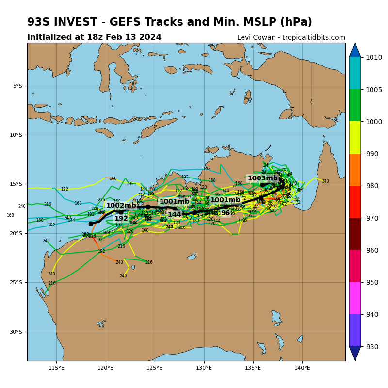
Image: GEFS ensemble member tracks for Tropical low 07U. Source: TropicalTidbits.com
The image above shows the low reaching the waters to the west of the Kimberley by mid next week, bringing the potential for the first tropical cyclone to impact the West region this season.
The image below shows one model’s forecast rainfall with widespread falls of 100-200mm and isolated falls of 300-500mm possible in the next 7 days across northern NT, WA, and Qld.
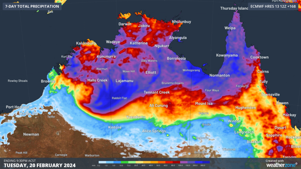
Image: Accumulated rainfall forecast for the 7 days leading up to 9:30pm ACST on Tuesday, February 20.
Over the weekend and into next week, this system is expected to track back towards the west into the central NT, bringing further heavy rainfall with it. These areas were recently flood-affected by tropical low 03U in January that took a similar path.
We will monitor this system over the coming days for possible cyclogenesis, and for further heavy rain and flooding that this system brings along. Stay up to date with the latest warnings and news at Weatherzone.com.au.
As the climate delivers increasingly severe weather events, their potential to impact your business operations grows.
DTN APAC, specialises in industry-leading forecast, alerting and threat analysis of tropical cyclones, offering you expert, customised solutions when the weather turns wild.
Providing rapid-update forecast information, we alert you to any low-pressure system gaining power within your region and, unlike other providers, can track its development out to 7 days. This gives you the time to prepare and safeguard your staff, sites and assets.
You will have the most precise weather intelligence charting rainfall, wind speeds and potential storm surges to help you make critical decisions quickly. Whether it’s adjusting key work schedules, protecting your staff or securing your site, we have the alerting capability to keep you steps ahead of the storm.
We will support you, 24/7, keeping you informed and making your critical decisions easier. For more information, please contact us at apac.sales@dtn.com.




