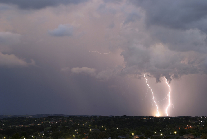
Thunderstorms will develop over parts of NSW on Wednesday, with severe storms possible in the afternoon and evening.
The low pressure trough that triggered severe thunderstorms in parts of Vic and southern NSW on Tuesday will move further north across NSW on Wednesday. This system is likely to trigger showers and thunderstorms over a broad area of central and northern NSW on Wednesday afternoon and evening.
While NSW is not expected to see a repeat of Tuesday’s high impact weather that cut power to more than half a million customers in Victoria, there is a decent chance of some dangerous storms.
The most likely area in NSW to see severe storms on Wednesday is the eastern inland, including the Hunter and areas west of Sydney. Some severe storms area also possible near the state’s central Coast, including Sydney.
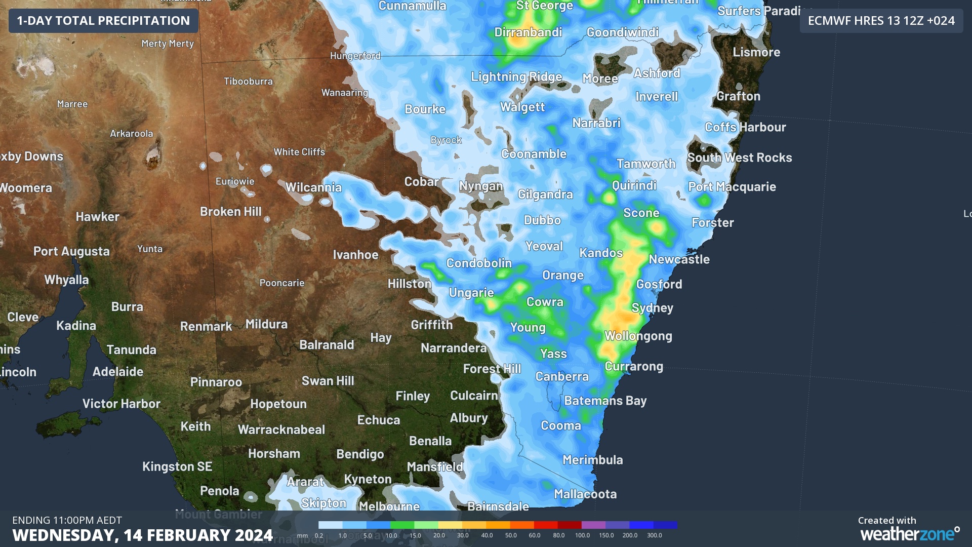
Image: Forecast accumulated precipitation on Wednesday, according to the ECMWF-HRES model.
One thing that has been working against storm development is the presence of high cloud on Wednesday morning, which limited heating near the surface early in the day, which reduce the energy available for storms in the afternoon.
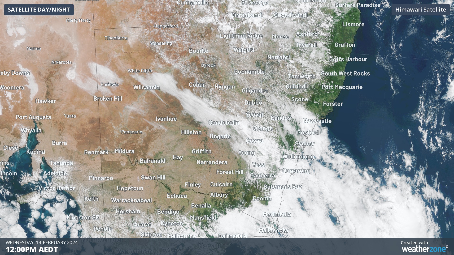
Image: Visible satellite image captured at midday AEDT on Wednesday, showing predominantly high cloud over parts of central and eastern NSW.
However, if enough surface heating occurs in the gaps between these high clouds, storms shouldn’t have any trouble developing in the unstable atmosphere over eastern NSW.
Anyone that will be doing school pickup or commuting in eastern, central or northern NSW on Wednesday afternoon should check the radar and latest warnings before heading out.
DTN APAC delivers a proven aviation weather briefing system, developed in collaboration with the industry, to keep your enterprise performing at peak efficiency.
We meticulously tailor actionable weather intelligence to suit the scope of your company’s work, on the ground and in the air. Accurate and comprehensive international data informs your daily decisions on safety, fuel loads and staffing.
Working alongside our global network of partners and suppliers we collate the data to give you full situational awareness of both en route and port specific conditions. Weatherzone is accredited and adheres to standards for aviation meteorology set by the World Meteorological Organisation (WMO) and the International Civil Aviation Organisation (ICAO). Registered with the ICAO and providing safety critical OPTMET data with permission from Air Services Australia, our aviation services meet the industry’s stringent requirements.
This is weather intelligence delivered in an easy to visualise format. No matter what the weather has in store, we give you clear foresight to make informed decisions. For more information, please contact us at apac.sales@dtn.com.


