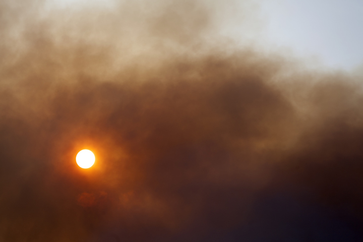
Bushfires raged in and around Perth’s northern suburbs overnight and continue to threaten lives and homes on Thursday morning, as the ongoing late spring heatwave bakes western parts of WA.
The fires are concentrated in the City of Wanneroo and the City of Swan – local government areas fringing Perth’s north and northeastern suburbs – with numerous suburbs including Jandebup, Banksia Grove, and Mariginiup remaining at risk.
Multiple warnings are in place, and please check the latest at the Emergency WA page.
Pretty scary footage coming from Banksia Grove. Hope everyone is staying safe. pic.twitter.com/h0s8kAHLTs
— Greg Hire (@greg4hire) November 22, 2023
Just after 7 am (AWST), the WA Department of Fire and Emergency Services (DFES) issued a warning urging people to stay away from the warning area, stating “It is not safe and puts additional pressure on emergency services personnel who are working in the area to keep the community safe”.
The DFES said it is too late to leave for people east of Pinjar Road to leave and that they should shelter in place immediately. It also notified the public that an animal evacuation area has been set up at the Wanneroo Showgrounds.
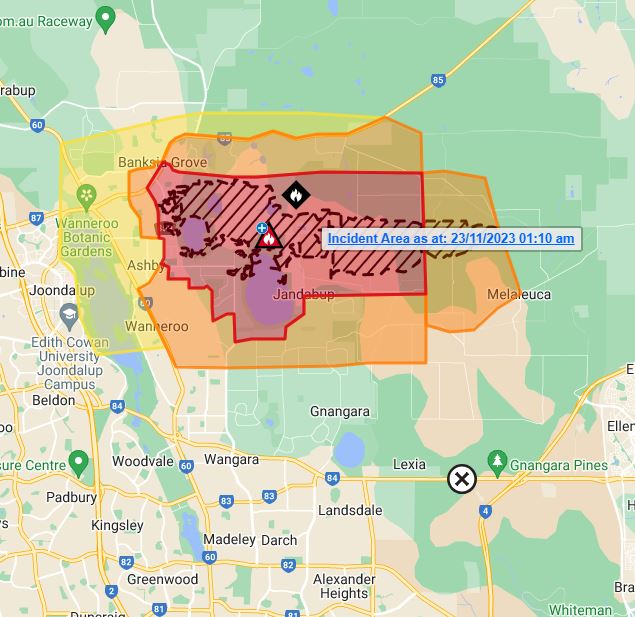
Image: A map showing the bushfire area in the very early hours of Thursday morning. Source: DFES.
This is an ongoing emergency situation and while there are unconfirmed reports of homes lost in the suburb of Tapping and elsewhere, the picture will be clearer throughout the day.
For the latest info, we urge you to follow the live blog at The West Australian. Normally their content is behind a paywall but it appears that fire emergency info can be accessed by all.
On the weather side of things, Perth is heading for a top of 40°C today, which as we told you on Monday, could give the November record maximum of 40.4°C a shake.
Max temps in the high 30s with dry, gusty east to northeasterly winds are likely until Sunday, which means that dangerous fire weather will persist for at least the next four days.
Working in often severe conditions in the high-risk fields of forestry and emergency, our consolidated weather services can ensure full situational awareness for you and your team.
DTN APAC serves the forestry and emergency sectors, delivering trusted weather data and severe weather alerting to maintain safety, protect your assets and underpin your planning.
Weatherzone’s trusted nowcasting and forecasting system, OpticastTM, is independently proven to outperform other industry models, allowing you to respond rapidly to changing conditions. Opticast can ingest data from your on-site weather observation equipment, ensuring your forecast is customised to your local microclimate. From nowcasting and 14 day forecasting to seasonal outlooks, you have powerful, hyper-local weather alerting and intelligence, giving you decisive confidence when it’s most needed.
With lightning a prominent cause of forest fires throughout Australia, Weatherzone’s Total Lightning Network offers real-time detection and unsurpassed accuracy of lightning strikes to <200m. Based on a vast sensor network, both intra-cloud and cloud-to-ground strikes are located, ensuring you are alerted when severe weather is building and threatening your teams, assets and infrastructure. When volatile conditions increase the ferocity of fire it’s imperative you have lead-time to enact safety plans, keeping your people out of harm’s way.
Your weather intelligence is accessible across all devices in your network via our Weatherguard App, and your customisable interface.
We are there for you when you need us the most – 24/7, 365 days a year. For more information, please contact us at apac.sales@dtn.com.


