There’s nothing too unusual about a burst of heat for Perth and nearby areas with summer almost upon us, but this week’s heat will be intense by November standards.
On Monday afternoon, the BoM issued heatwave warnings for numerous WA forecast regions, with a three-day heatwave warning in effect in a broad strip in the state’s west, from the southern Pilbara all the way down though Perth to Cape Leeuwin in the far southwest.
The map below tells the tale.
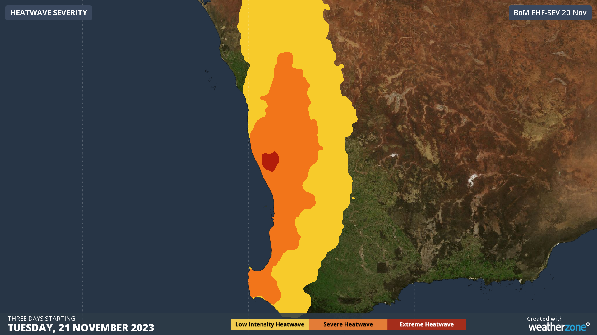
As you can see, large parts of the regions just mentioned will see a severe heatwave (orange), while there is even an area of extreme heatwave (red) not too far north of Perth.
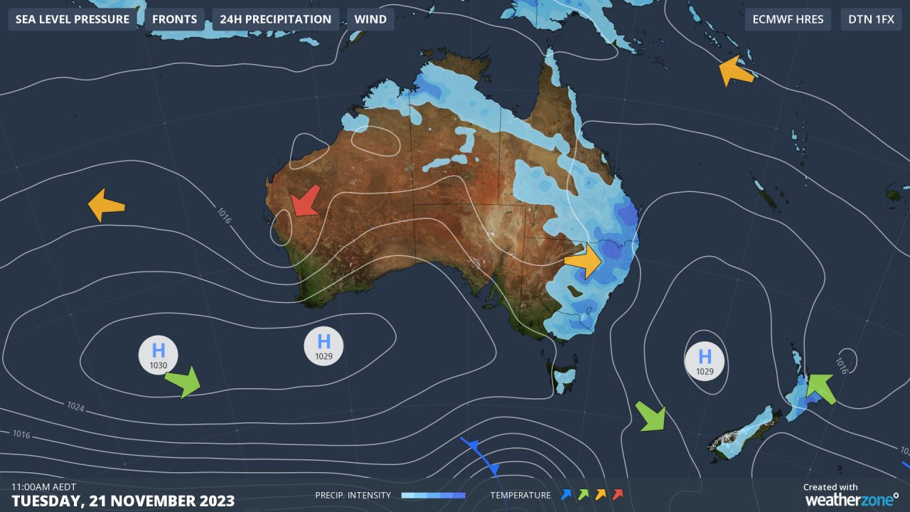
You can visualise the cause of the heat illustrated in simple terms on Tuesday’s synoptic chart, with hot winds from the state’s northern interior being funnelled towards the west coast as air circulates around that large high centred over the ocean south of WA.
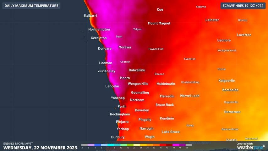
In terms of actual temperatures, Perth could challenge both its record minimum (25.1°C) and record maximum (40.4°C) with Wednesday looking like the hottest day, and Thursday the hottest morning. We’ll keep you posted on that.
Temps could even climb to 44°C or 45°C in parts of the Central West district. That’s the forecast region north of the Lower West district (where Perth is located) and it’s the area where the bulk of the red blob is on the heatwave map.
As ever please check our warnings page for the latest info on severe heatwaves and other dangerous weather.
DTN APAC is a diverse team, with global forecasting, product development and analytics expertise. Couple this with extensive industry experience spanning Aviation to Energy, and we are primed to assist you in strengthening your response to weather
impact.
We work hard to identify your operational pressures and tailor our services and products to meet your needs. Concise communication, giving you full situational awareness exactly when you need it, is our focus. We want to reduce weather risk in your operations, every day.
We deliver clear and comprehensive weather data, personalised risk assessments and briefings to you and your team, so that your critical decisions can be made with confidence.
We are available 365 days a year, so you always have the timely guidance you require, especially when severe conditions hit.
You have our insights to rely on to see you through complex situations, minimising potential loss of profit and maximising the safety of your staff and assets. For more information, please contact us at apac.sales@dtn.com.


