Stormy end to March for northern Australia
An active end to March is on the forecast for the Australian tropics, as the Madden Julian Oscillation (MJO) lingers in the Australian region. An increase in tropical activity has already been seen in the Indian Ocean...
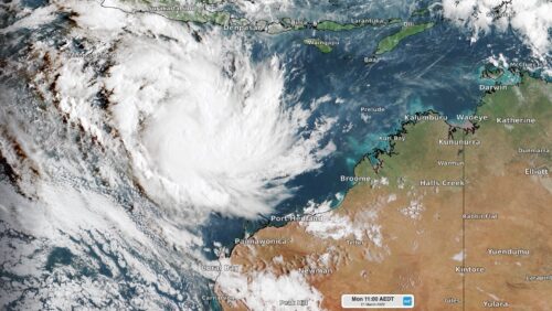
Australia’s second severe tropical cyclone formed this morning
Tropical Cyclone Charlotte strengthened rapidly overnight, becoming Australia’s second severe tropical cyclone so far this season. Charllotte was located around 1000 kilometres to the northwest of Port Hedland at 6:40am WST on Tuesday, March 22. The system is...
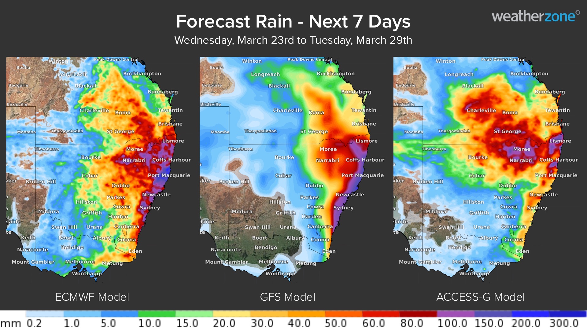
More rain on the horizon for eastern Australia
Parts of Queensland and NSW could be hit with heavy rain later this week, raising the risk of more flooding in already saturated river catchments. A slow-moving upper-level trough interacting with moisture-laden air will allow rain and storms...
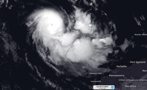
Cyclone Charlotte develops northwest of WA
Tropical cyclone Charlotte developed to the northwest of Australia on Monday morning, becoming our eighth named cyclone so far this season. The satellite image below shows Charlotte sitting around 900km to the northwest of Port Hedland at 8am...
Severe weather and the expense to Australian utilities
Recent weather events, such as tropical cyclones and record-breaking flooding, have once again brought into focus the resiliency of utilities. Even though utility companies are continually evaluating their grid systems and investing in resilience measures, weather events can cause...
MJO imminent for Australian region
Parts of northern Australia could see a wet end to March as the Madden-Julian Oscillation (MJO) moves through the Australian region. The MJO is a pulse of increased cloudiness and rainfall that travels around the world near the equator...
Could we see a third consecutive La Nina?
A highly regarded international long-range forecast model is hinting at the possibility of a third consecutive La Niña event later this year. But before getting too worried about the prospect of a triple-dip La Niña, there are a few reasons...
Today, solar and wind farms could be affected by severe thunderstorms
Severe thunderstorms will develop over Australia’s eastern inland on Tuesday, possibly affecting solar and wind farms across parts of the National Electricity Market (NEM). A broad low pressure trough stretching more than 3000 km across northern and eastern...