Tropical Cyclone Sean has intensified into a severe Category 3 storm, with record-breaking rainfall and damaging winds likely impacting mining, rail and port operations in the Pilbara region.
Overnight, it lashed Western Australia’s Pilbara coastline with extremely heavy rain and damaging winds, however the good news is that it is now predicted to track out to sea in a southwesterly direction.
In the latest BoM bulletin issued at 8:48 (AWST), the storm was:
- Located 205 kilometres northwest of Exmouth and 285 kilometres west northwest of Onslow.
- Packing sustained winds near the centre of 150 km/h with gusts to 205 km/h.
- Moving in a southwesterly direction at 20 km/h.
- Still generating heavy to locally intense rainfall along WA’s Pilbara coastline from Mardie to North West Cape.
- Possibly intensifying to Category 4 later today, albeit well off the coast.
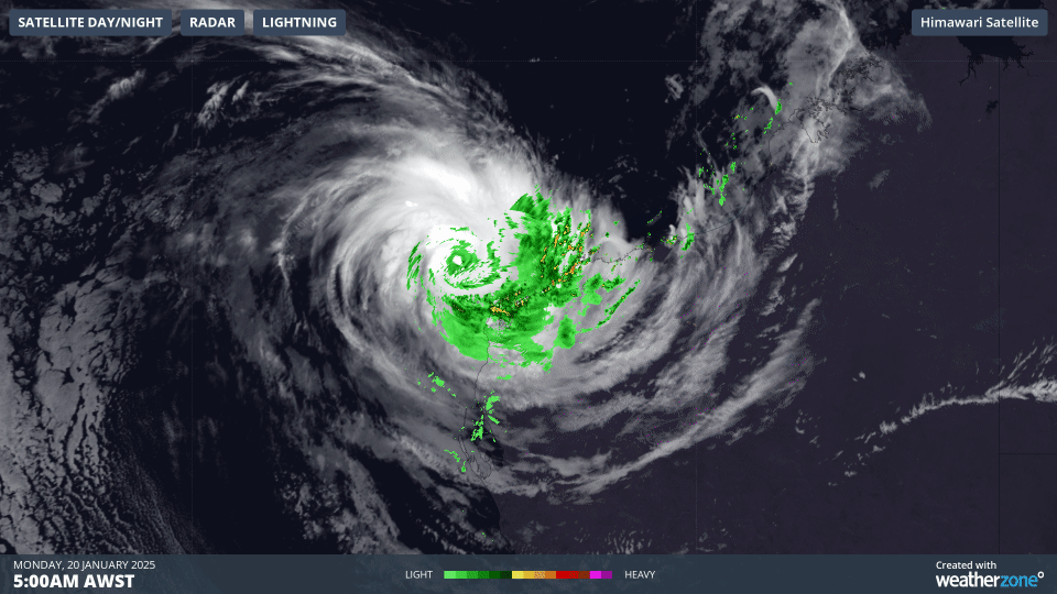
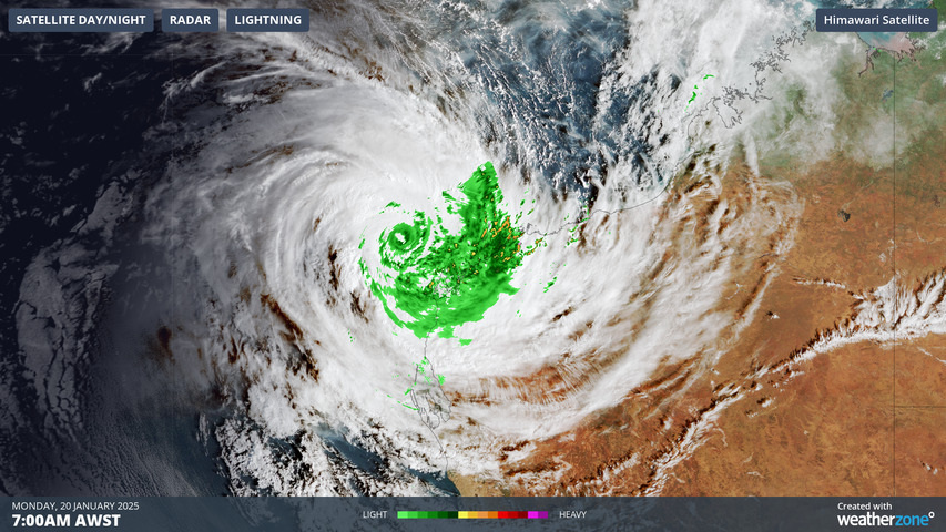
Image: Three-hour loop showing heavy rain around the eye of Cyclone Sean off the WA coast as dawn breaks on Monday, January 20, 2025.
Damaging winds have lashed parts of the Pilbara, with Onslow airport recording a mean wind speed of 83km/h and a gust of 98km/h. Legendre Island just offshore the Pilbara recorded the highest mean of 98.2km/h with a gust of 118.5km/h in the early hours of Monday morning.
Extremely heavy rainfall totals exceeding 100mm were recorded at numerous Pilbara region locations in the 24 hours up until 9am Monday (AWST) with the large town of Karratha (population 17,000) topping the list:
- Karratha recorded 274.4mm in the 24 hours to 9am.
- The old monthly record for January (in more than 50 years of records) was 263.4mm.
- That means that Karratha has exceeded its entire monthly January rainfall record in a single day.
- Indeed, Karratha has just had its wettest day on record in any month.
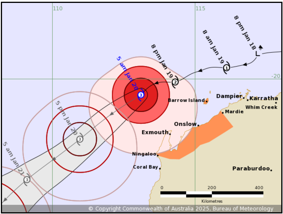
Image: The BoM’s predicted path for Severe Tropical Cyclone Sean on Monday, January 20, 2025 into the early morning of January 21. Source: BoM.
As the track map above shows, the cyclone is expected to steer clear of the WA coastline for the duration of its life.
However as it moves in a southwesterly direction more or less parallel to the coast, a storm tide is forecast between Onslow and Exmouth during Monday afternoon’s high tide.
Large waves could produce minor flooding along the foreshore and the BoM advises people in areas likely to be affected to take reasonable measures to protect their property and be prepared to help their neighbours.
Severe Tropical Cyclone Sean is the second cyclone of the 2024/25 season in the Australian region, after Cyclone Robyn in November – a storm which caused damage in Indonesia but had little to no impact on Australia.
In an average tropical cyclone season, we typically see around 9 to 11 tropical cyclones inside Australia’s area of responsibility.
Our meteorologists at DTN APAC have been providing our clients with industry-leading forecasts, alerting and threat analysis of this system, well in advance. We have been providing rapid-update forecast information including rainfall, wind speeds and potential storm surges tailored to our clients assets and unique thresholds, making critical decisions easier. For more information contact us at sales.apac@dtn.com


