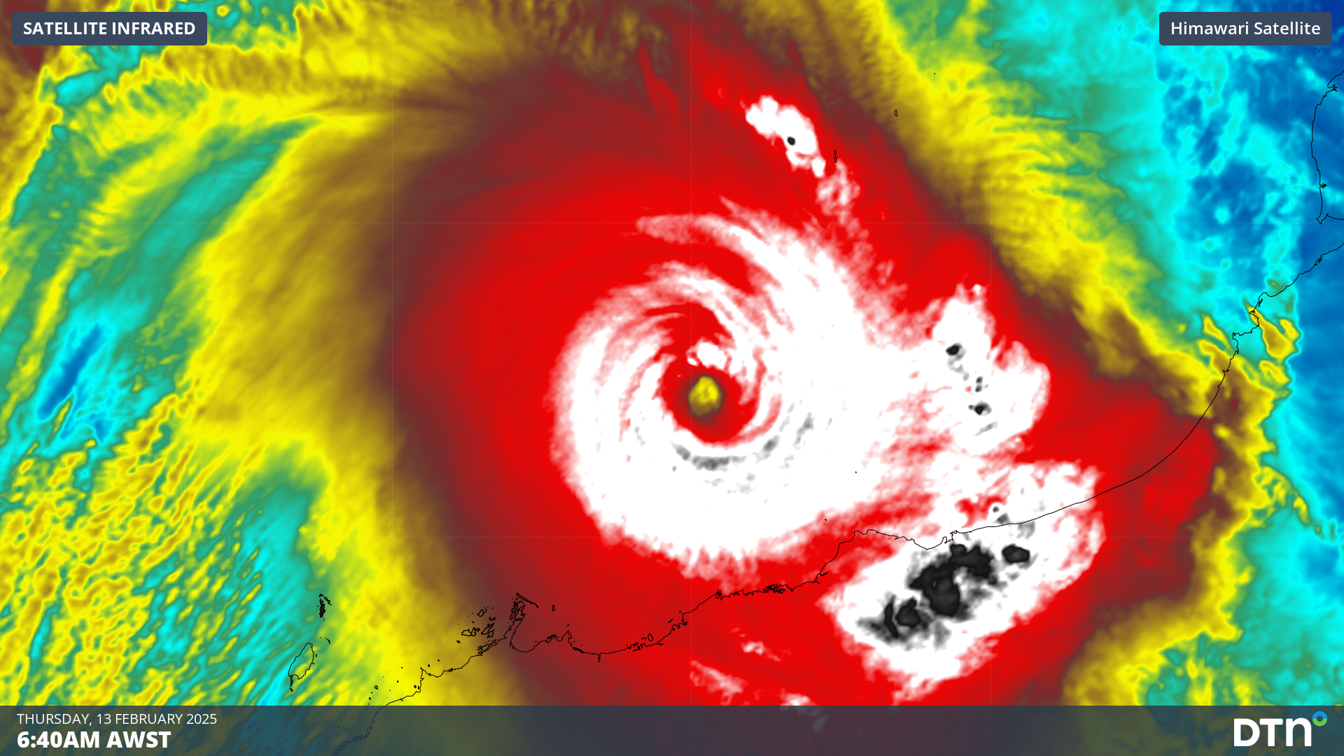
Severe Tropical Cyclone Zelia is intensifying rapidly to the north of Western Australia and is expected to make landfall as a destructive category 5 system on Friday, impacting mining, port and offshore oil and gas operations in the region.
While Zelia only became a tropical cyclone on Wednesday morning, the system has intensified rapidly over the past 24 hours. At 5am AWST on Thursday, Zelia was a category 4 severe tropical cyclone located roughly 140 km to the north-northwest of Port Hedland, with sustained wind speeds reaching 175 km/h near its centre.
Sunrise on Thursday morning illuminated a symmetrical eye at the cyclone’s centre, which is a tell-tale sign of a severe tropical cyclone.
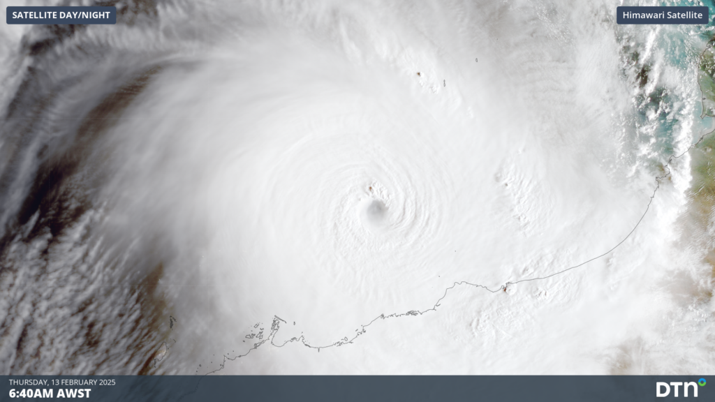
Image: Satellite image showing Severe Tropical Cyclone Zelia to the north of WA on Thursday morning.
Despite already being less than 150 km from the coast, the future movement and development of Severe Tropical Cyclone Zelia is fraught with uncertainty.
The system is likely to remain slow-moving during the rest of Thursday, allowing it to continue to strengthen in a favourable environment. Zelia is then expected to move towards the south on Friday, causing it to approach WA’s Pilbara coast, most likely as a category 5 severe tropical cyclone. However, forecast models are not agreeing on the timing or location of landfall. This uncertainty is important, because the longer Zelia stays over water, the stronger it will become before crossing the coast.
The latest forecast track map from the Bureau of Meteorology, issued at 6am AWST on Thursday, predicts that Zelia will make landfall near Port Hedland as a category 5 tropical cyclone on Friday evening.
Another forecast track, issued the U.S. Joint Typhoon Warning Center (JTWC), predicts that Zelia will make landfall further west, closer to Roebourne, on Friday night. The JTWC forecast also brings Zelia ashore as a powerful category 5 severe tropical cyclone, with peak wind gusts of around 320 km/h.
The uncertainty around Zelia’s future movement and strength makes it difficult to accurately predict the timing, location and severity of its impacts. However, there are clear signs that a category five severe tropical cyclone is about to hit the Pilbara coast, so some areas will see heavy rain, flooding, thunderstorms, very destructive winds and a storm surge in the next 24 to 48 hours.
Image: Composite satellite, radar and lightning heatmap, showing a ring of lightning as thunderstorms surround the eye of Severe Tropical Cyclone Zelia.
Zelia could become the first category five tropical cyclone to make landfall within 50km of Port Hedland since Dean in 1980. However, Dean was only a borderline category 5 tropical cyclone, with peak sustained wind speeds of 200km/h. Zelia is expected to be stronger than this, with sustained wind above 200km/h and peak wind gusts of around 290 to 320 km/h.
Severe Tropical Cyclone Dean caused extensive damage at Port Hedland, while Marble Bar, Goldsworthy, Mt Newman and pastoral stations up to 500km from the coast also suffered damage from wind. The flooding from Dean also damaged roads a railway lines between Port Hedland and Mt Newman.
The shifting climate is creating increasingly complex extreme weather risks, affecting businesses worldwide. We are here to help optimise your resilience.
Our Risk Communicators work closely with you to analyse how weather impacts your operations and communicate potential risks. We can then support your risk management planning, and provide situational awareness and post-event reporting when extreme weather events hit hard.
DTN APAC, is a diverse team, with global forecasting, product development and analytics expertise. Couple this with extensive industry experience spanning Aviation to Energy, and we are primed to assist you in strengthening your operational strategies when responding to weather disruption.
We consult with you to understand the nuances of your operations and your existing procedures and policies. We can then assist in creating communication structures, safety strategies and procedures to mitigate the risks that may impact your workforce, assets and uptime.
Rely on our insights to see you through complex situations, maximizing the safety of your staff and assets, and your uptime where possible. For more information contact us at sales.apac@dtn.com


