A steady stream of thick cloud and rain is set to impact parts of Qld during the next 3-4 days, reducing solar output in the region.
The prolonged period of thick cloud and rain is being caused by tropical moisture feeding into a near-stationary low pressure trough.
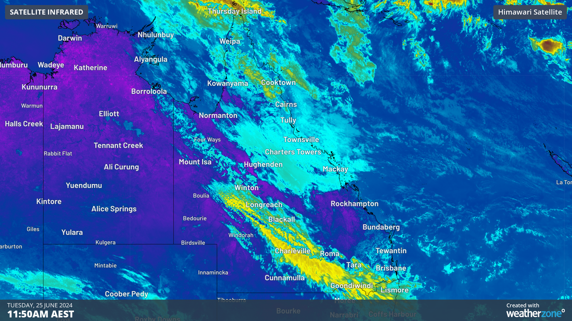
The images below show thick cloud impacting the northern and central solar generation zones on Tuesday morning.
Images: Himawari-9 satellite images for the three hours leading up to 10:50am AEST on Tuesday, June 25.
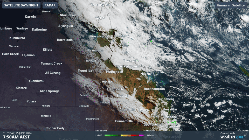
Whilst the radar had been showing no precipitation on Tuesday morning, the rain should begin this afternoon and evening across northern and central Qld.
During the next three days widespread falls of 20 to 40mm, with isolated falls of 60 to 80mm are possible.
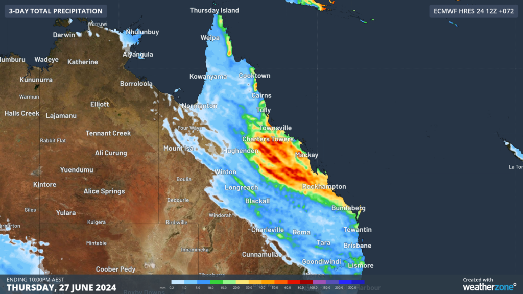
Image: Accumulated rain forecast for the three days leading up to 10am on Friday, June 28
Rain and cloud will scatter across central and northern Qld on Tuesday and Wednesday before spreading south towards Brisbane on Thursday.
The rain should ease on Friday or Saturday, however a northwest cloudband is expected to arrive in southern Qld later this week into early next, reducing solar output again in the region.
The image below shows the solar facilities in Qld, which are likely to be impacted by these events.
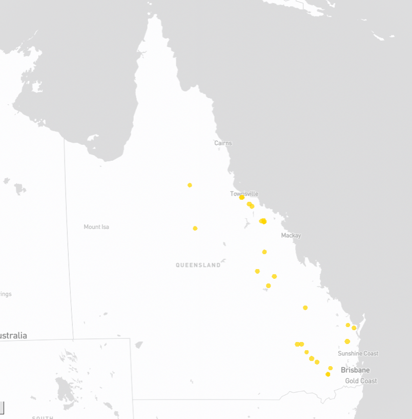
Image: Solar facility (yellow dots) locations in Qld, according to OpenNEM.
Looking ahead, the models suggest that the clouds will part with some sunny periods mid to late next week following the northwest cloudband.
Fortunately, this period of slack solar is being met by increased wind power across the National Electricity Market during the next week.
Weatherzone Business and Solcast are a market-leading partnership delivering highly specialised solar data to the Australian renewable energy industry.
Designed for utility scale solar sites, we offer you a globally proven solution.
With low upfront CAPEX and powerful cloud-based information systems, you can access a complete suite of irradiance and weather data to ensure forecast accuracy and improve site efficiency.
Solcast is the world leader in real-time actuals and rapid-update solar forecasts. This solution utilises Solcast’s centralised Amazon Web Services’ (AWS) cloud infrastructure for all complex algorithmic processes and data plumbing. You will gain the power of AWS to interpret and deliver your data at top speed, providing real-time, historical and forecasting estimates direct to your API.
Receive monitoring and support from the Weatherzone and Solcast teams, 24/7. To find out more, please contact us at apac.sales@dtn.com.


