The Australian snow season is expected to take off to a slow start in 2025, but conditions could become better into the second half of the season.
When is Australia’s snow season?
Australia’s snow season typically runs between the long weekends in June and October. In 2025, the snow season will run from about June 7 to October 6, although the exact start and end dates can vary slightly between individual resorts.
In an average season, the natural snow base builds up during June and July before reaching a peak depth in August or early September. This base then melts promptly in October as temperatures start to climb in spring.
The key dates for Australia’s 2025 snow season are:
- Official Season: June 7 to October 6, 2025
- Peak Snow Depth Period: Most likely August to September
- Opening Weekend: June 7-8, 2025 (Long Weekend)
- Closing Weekend: October 4-6, 2025 (Long Weekend in NSW/ACT/SA)
Australia snow season 2025 forecast
Snow requires two key ingredients to reach the ground: sufficiently low temperatures and adequate moisture. Having one ingredient without the other won’t produce snow, so we need cold air and precipitation to occur over the Australian alps at the same time for snow to settle.
Forecast models suggest that conditions could be unfavourable for snow early in the season but should improve as the season progresses.
The ECMWF SEAS5 model, which is one of the most highly regarded seasonal forecast models in the world, predicts below average precipitation and above average temperatures over the Australian alps in June.
 Image: Forecast precipitation anomaly for June 2025, according to the ECMWF SEAS5 model.
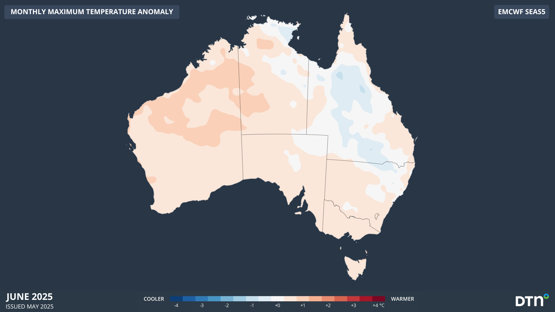
Image: Forecast maximum temperature anomaly for June 2025, according to the ECMWF SEAS5 model.
These abnormally warm and dry conditions could see June struggling to produce a good natural snow base at the start of the season. A similarly slow start to the season occurred in 2020 and 2017, which both had less than 30 cm of natural snow on the ground at Spencers Creek, NSW (elevation 1830m) by the end of June. However, this does not mean that the 2025 snow season is likely to follow the patterns of 2020 and 2017 for the whole season.
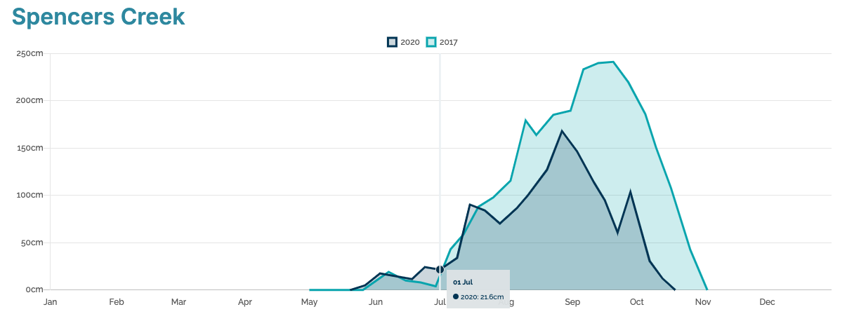
Image: Natural snow depth observations at Spencers Creek, NSW in 2020 and 2017. Source: Snowy Hydro
Fortunately, the prospects of snow in the Australian alps start to improve into the second half of winter, partially in response to the possibility of a negative Indian Ocean Dipole (IOD) developing to the northwest of Australia.
Some forecast models predict a signal of above average precipitation from July through the second half of winter and into early spring. If this precipitation teams up with freezing temperatures in the mountains, we can expect to see plenty of snow.
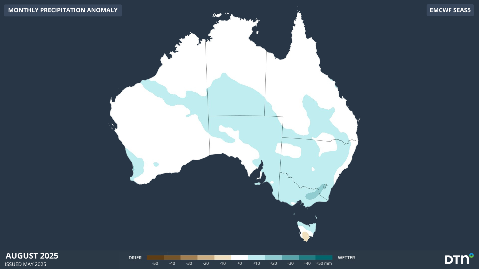
Image: Forecast precipitation anomaly for August 2025, according to the ECMWF SEAS5 model.
Daytime maximum temperatures are predicted to be slightly higher than average in July but could trend closer to average by August. Despite the background warming influence of climate change in Australia, July and August are climatologically the coldest months of the year in the alps, so there should be plenty of cold air to produce snow in late winter and early spring.
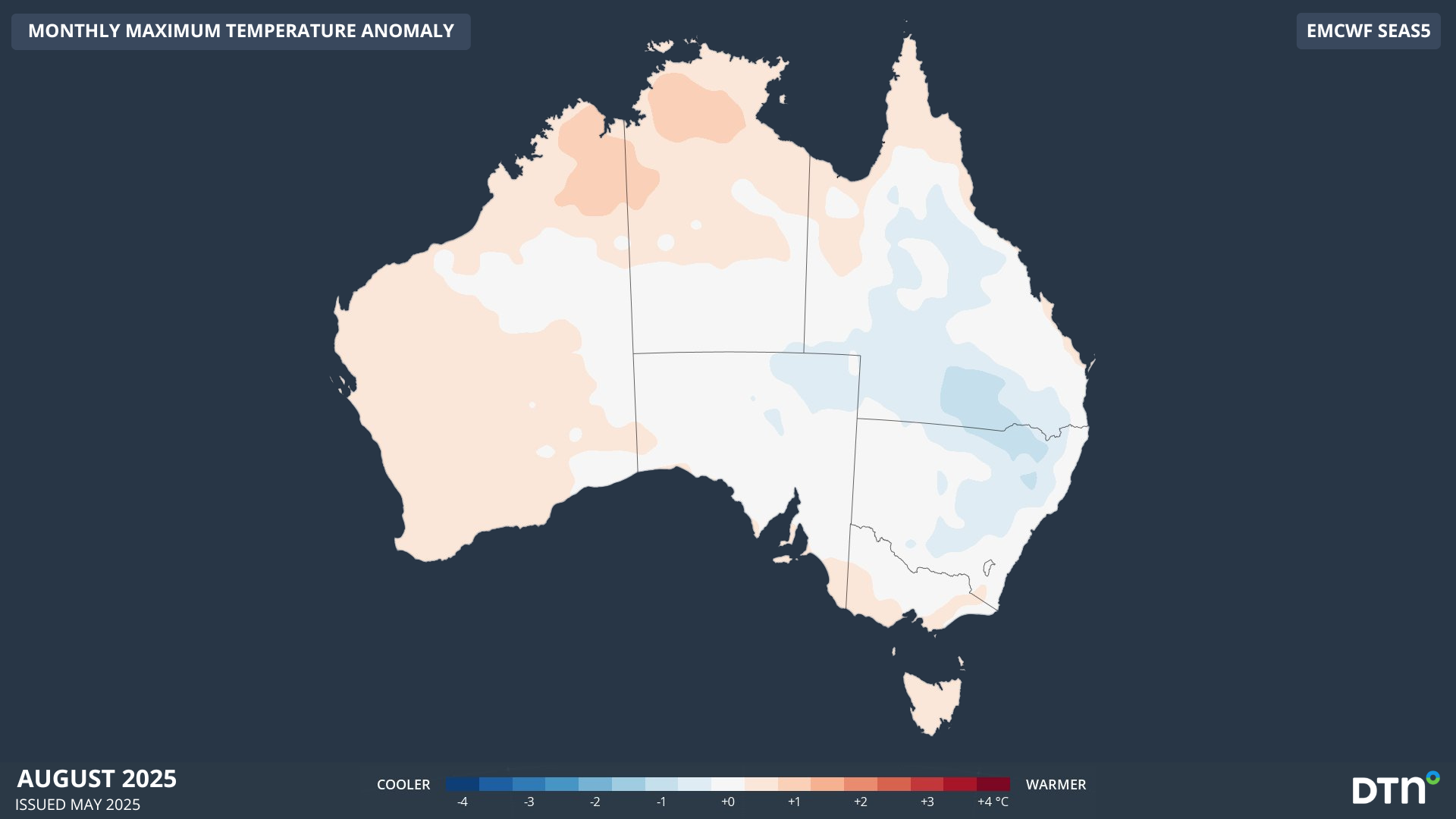
Image: Forecast maximum temperature anomaly for August 2025, according to the ECMWF SEAS5 model.
The biggest risk to the Australian snow base during August and September will be periods of rain in warmer air masses between cold outbreaks. These rainy periods are difficult to predict at the seasonal scale and can have a big impact in some seasons and little effect in others.
What does this mean for Australia’s 2025 hydropower season?
For the start of the season, streamflows over hydropower areas are expected to continue being lower than average in response to the ongoing drought in the region. With the expectation of better conditions for snowfalls in late winter, streamflows are expected to increase during spring as the snow starts to melt. Periods of heavy rain also become more likely over the mainland during spring that may also increase streamflows, and therefore hydropower production.
DTN APAC can help your hydropower and renewables business
DTN APAC, supplies weather data and analytics to support all aspects of your renewables business (including solar, wind energy, and hydropower) with a wide range of specialised services covering energy generation and weather forecasting, to site-specific severe weather alerting and historical reporting.
For hydropower, our Opticast nowcasting and forecasting capabilities provide you with a long-term outlook covering rainfall and extreme heat events out to 12 months. This can significantly improve your planning as you integrate the data with site-specific hydrological parameters.
With renewables making up more of Australia’s energy mix every year, we want to support your business to make informed critical decisions and improve your overall generation and safety. For more information, get in touch with our experts at apac.sales@dtn.com


