Much-needed snowfalls are coming to Australia’s alpine region this weekend, good news for the hydropower industry in Australia.
We’ve written several times this week about the strong cold airmass with Antarctic origins which is tracking towards southeastern Australia from this weekend onwards. The airmass will linger for an unusually long period, and will be cold enough for snow in elevated areas well beyond the mountains.
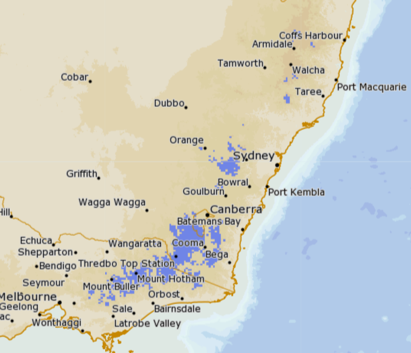
Image: As you can see on this BoM Meteye chart for Monday July 15 where purple blotches, mean snow, flakes are expected right up to the NSW Northern Tablelands. Source: BoM.
How much will fall on ski slopes where it’s really needed?
The short answer is that 25 to 50 cm should fall at most resorts between about Saturday and Thursday. We could even get lucky and see heavier falls. But the bottom line is that snowfall totals from weather systems like this are not easy to predict.
In winter, we tend to look for moisture-laden cold fronts crossing the Great Australian Bight that surge northwards, delivering snow across the alpine areas of the southeast. This system is a little different.
While a front will approach on Saturday with the chance of a few associated snow flurries, there won’t be much moisture accompanying the initial temperature drop.
The main action kicks off later on Sunday into the working week, as a ferocious low pressure system forms in the Tasman Sea.
With a broad pool of cold air lingering over the southeast, this low has the potential to funnel large amounts of moisture over the mountains.
But it will likely be hit and miss – as these systems tend to be. Some resorts might be lucky to see more than a few centimetres. Others could get a dump they talk about for years.
There is also the potential for some dramatic temperature fluctuations early next week as the low brings in warmer air from the Tasman Sea. At times, we could see an atmospheric battle between frigid air over the mainland and mild maritime air, with the snow level dropping and rising accordingly.
The resort where things look really exciting is Mt Baw Baw, the closest ski hill to Melbourne and Australia’s lowest resort, topping out at just 1550m. Poor old Baw Baw has done it tough in recent years and there’s strong evidence of declining snowfall as the climate has warmed.
But occasionally, the weather gods still conspire up to deliver huge totals to Baw Baw. That usually happens in a strong southerly or – as will be the case next week – when a low is positioned in just the right spot off the East Gippsland coast.
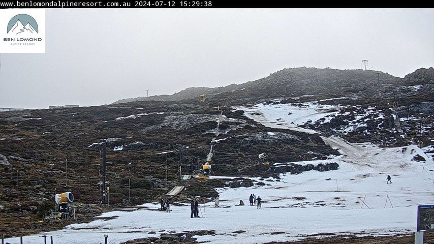
Tasmania’s only commercial ski resort, Ben Lomond near Launceston, is also in line for its first significant snowfalls of the 2024 winter. At present, its barely skiable snow cover is entirely machine-made.

Image: You’ve gotta love the resilience of Aussie skiers. Source: Ben Lomond Alpine Resort.
For the main NSW and Victorian resorts including Perisher, Thredbo Charlotte Pass, Selwyn, Mt Hotham, Falls Creek and Mt Buller, the signs are promising. But for now, it’s a matter of wait and see what Monday brings.
The good news is that this system has opened the door (so to speak) for further snowy systems, with good pointers to snow-bearing cold fronts peaking in eastern Australia in the coming two-week period.
As ever, keep checking our snow page for the latest forecasts, snow cams, and more.
Hydropower
Using Opticast’s nowcasting and forecasting capabilities, you will have long-term outlook covering rainfall and extreme heat events out to 12 months. This can significantly improve your planning as you integrate the data with site-specific hydrological parameters.
With renewables making up more of Australia’s energy mix every year, we want to support your business to make informed critical decisions and improve your overall generation and safety. For more information, please contact us at apac.sales@dtn.com.


