Sydney has suffered through a relentless rainy spell, with only 3.8 hours of sunshine a day recorded on average during the first 7 days of July.
This cloudy week was well below the average of 7 sunshine hours per day that the city typically sees in July, reducing rooftop solar output across the city. However, this was not the cloudiest beginning to July, during 2022 the city received an average of 0.44 hours per day, with 280.4mm falling in the gauge during this time.
After a light shower fell at the city’s Observatory Hill weather station on Tuesday afternoon, the rain streak officially stretched out to 11 days of recorded rainfall, with 58.6 mm in total for July as of 4 pm Tuesday.
That wasn’t the longest wet streak this year.
- May 2024 started with two straight weeks of rain – a 14-day soggy stretch.
- Sydney’s rain was also heavier in May, with six of the 14 days seeing 20 mm or more.
- By contrast, the highest fall on any day in the last 11 days was 13.2 mm.
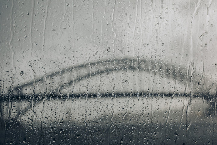
But it has still been relentlessly, frustratingly, miserably wet for Sydneysiders desperate for a few rays of sunshine to help offset the winter chill – and for a window to get the washing hung out.
Well, that window has now arrived. Fine weather is on the cards for Wednesday and Thursday and the city should enjoy relatively mild top temps of 19°C and 18°C respectively.
Couldn’t resist this Sydney Icons picture during a brief respite from the rain. pic.twitter.com/tmTlivPXmk
— Fergus McLachlan, AO (@FMcL2020) July 9, 2024
Conditions will then cool down from Friday into the weekend and continue chilly into the new week with top temps in the mid-teens as an outbreak of air with Antarctic origins surges across southeastern Australia.
And while there might be a shower or two from Friday onwards, the rain shouldn’t be as heavy or frequent as it has been in July 2024 to date.
For those who enjoy statistics, in 2024 to date, Sydney has seen:
Four rainy streaks of five days or longer.
- 14 days from May 1 to 14
- 11 days from Jun 30 to July 9
- 5 days from Jan 14 to 18
- 5 days from Mar 15 to 19
Five out of six months where rainfall has exceeded the monthly average.
Three days on which 100 mm or more rain fell, and a further four days of 50 mm or more (so seven in total with 50 mm or more).
The rainiest month was June with 368.4 mm, almost triple the long term average of 131.7 mm.
Sydney exceeded its annual rainfall average of 1221.2 mm on June 23.
Check the latest Sydney forecast here, or Sydney’s long-term climate data here.
Weatherzone Business and Solcast are a market-leading partnership delivering highly specialised solar data to the Australian renewable energy industry.
Designed for utility scale solar sites, we offer you a globally proven solution.
With low upfront CAPEX and powerful cloud-based information systems, you can access a complete suite of irradiance and weather data to ensure forecast accuracy and improve site efficiency.
Solcast is the world leader in real-time actuals and rapid-update solar forecasts. This solution utilises Solcast’s centralised Amazon Web Services’ (AWS) cloud infrastructure for all complex algorithmic processes and data plumbing. You will gain the power of AWS to interpret and deliver your data at top speed, providing real-time, historical and forecasting estimates direct to your API.
Receive monitoring and support from the Weatherzone and Solcast teams, 24/7. To find out more, please visit our contact page or email us at apac.sales@dtn.com.


