
Tasmania and a few places on the Australian mainland just had their warmest July on record, while mid-winter rainfall was below average in much of southern Australia.
The national mean temperature in July 2023 was 1.19ºC above the 1961-1990 average, making it the country’s 9th warmest July in records dating back to 1910.
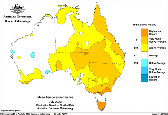
Image: Observed temperature deciles in July 2023. Source: Bureau of Meteorology.
The map above shows that the largest temperature anomalies in July occurred across eastern and southeastern Australia, particularly in Tas, and parts of Vic and NSW.
A lack of strong mid-winter cold fronts allowed Tasmania to register its warmest July on record. The state’s mean monthly temperature was a whopping 2.02ºC above the long-term average, beating the state’s previous July record from 1930 by 0.39ºC.
Parts of Victoria and NSW also registered a record warm July based on mean monthly temperature, including Sydney.
While temperatures were closer to average for much of WA and parts of the NT in July, Qld, NSW, Vic, Tas and SA all registered one of their top 10 warmest Julys on record.
One of the main drivers behind Australia’s abnormally warm July was an unusual dominance of high pressure over the Australian continent, which helped keep cold fronts to the south of the country.
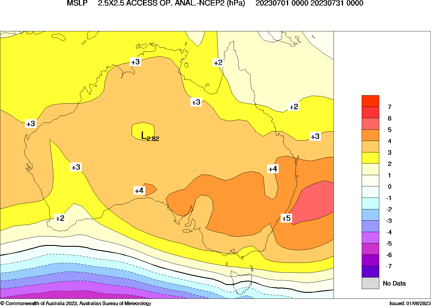
Image: Mean sea level pressure anomaly during July 2023. Source: Bureau of Meteorology
This suppression of seasonal frontal activity also limited rainfall across the southern half of Australia in July.
Victoria registered its 11th driest July in 124 years of records, while rainfall across the Murray-Darling Basin was about 40 percent below the long-term average.
A few places in Vic had their driest July on record, including Mallacoota in the state’s far east, where a paltry 8.6 mm reached the gauge during the month, well below its long-term monthly average of 80 mm.
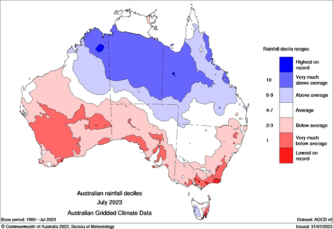
Image: Observed rainfall deciles during July 2023. Source: Bureau of Meteorology
In contrast to the dry July in southern Australia, parts of the nation’s north had an exceptionally wet month thanks to a burst of unseasonably heavy rain in the first few days of July. This deluge saw the NT register its wettest July since 2010 and its 9th wettest on record.
Unfortunately, the dry and warm July in parts of eastern Australia has exacerbated year-to-date rainfall deficiencies in parts of NSW and Qld. This is likely to help increase grass fire fuel loads as we head into the warmer months of the year.
On Tuesday, August 1, six Local Government Areas in northern NSW commenced their Bush Fire Danger Period for the 2023/24 season.
DTN APAC has a variety of forecasting and alerting tools on hand to help your business cope with the challenges that an El Niño can bring. For example, with the increase in bushfire risk, our hotspot detection will alert you to nearby fires (even small ones) so you can take action to protect your personnel and assets. To find out more please visit our website or email us at apac.sales@dtn.com.


