A series of cold fronts will cause a burst of windy weather across a large swathe of southern Australia during the next 4 to 5 days, with potential for widespread damaging winds this weekend.
The satellite images below show speckled cloud being driven over southwestern Australia on Wednesday morning as a complex low pressure system passes to the south of WA.
Early on Wednesday morning, this brisk southwesterly airstream caused wind gusts of 98 km/h at Cape Leeuwin and 80km/h at Rottnest Island. While wind was lighter in Perth early on Wednesday, the air was still moving fast enough to make 12-13ºC feel more like 8ºC shortly after 6am.
The southern half of WA will continue to be buffeted by brisk westerly component winds on Wednesday. While no severe weather warnings are in place, a sheep graziers warning has been issued for the South West and South Coastal districts, alerting farmers to the risk of losses of lambs and sheep in the cold, wet and windy weather.
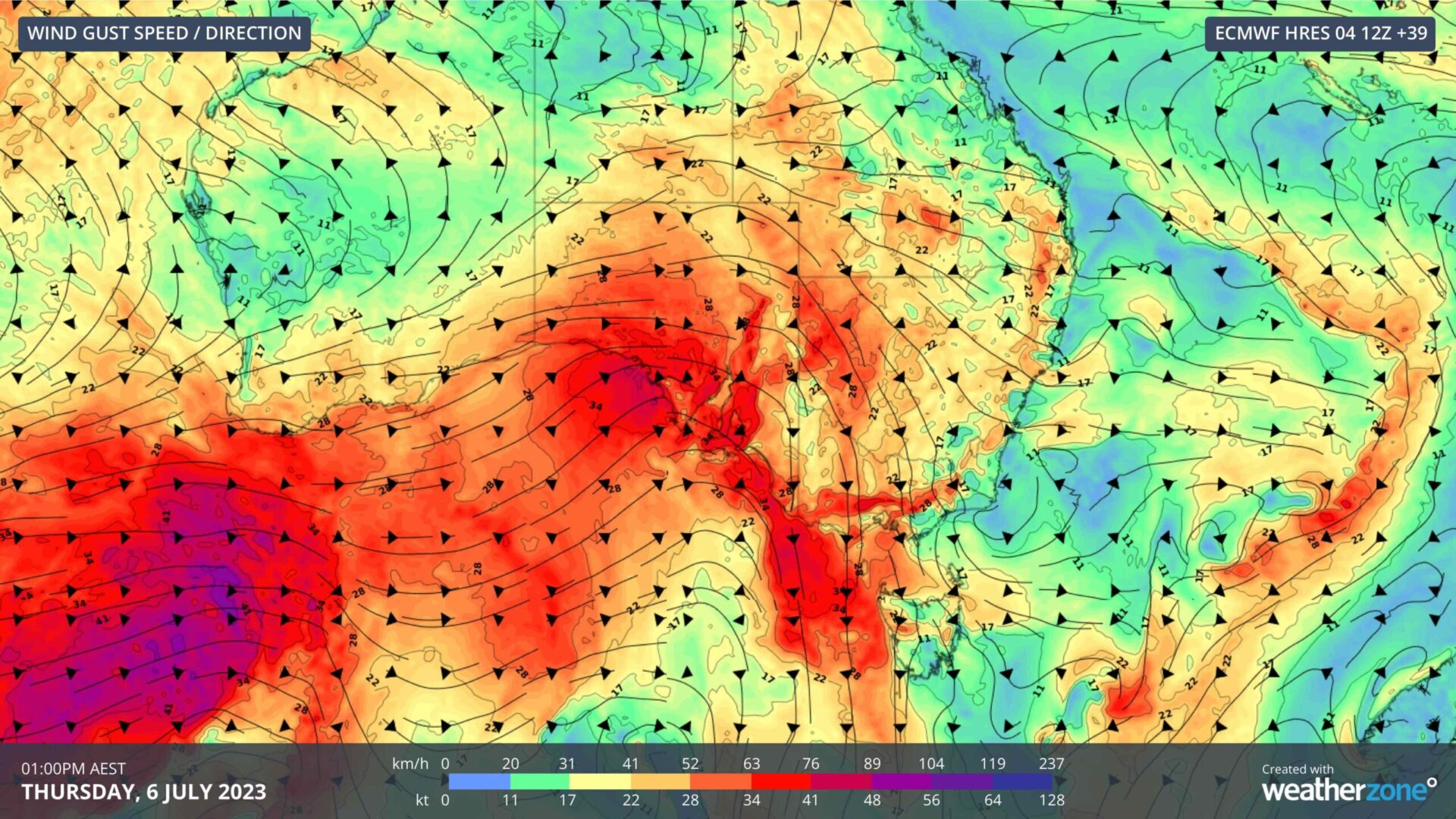
Image: Forecast wind gusts (speed and direction) at 1pm AEST on Thursday, July 6, according to the ECMWF-HRES model.
The low and an associated front will move further east on Thursday and Friday, causing wind and showers to increase over SA and parts of southeastern Australia. Cold air behind the front will also produce small hail and highland snow in some areas, adding to the wintry feel of this system.
A second strong cold front will then reach SA on Friday before crossing southeastern Australia on Saturday. This system is likely to cause stronger winds, with damaging gusts possible in parts of SA, Vic, Tas, NSW and the ACT between Friday and Sunday. This may include the Mount Lofty Ranges in SA, parts of central Vic, and the Blue Mountains and Illawarra coast in NSW. Showers, hail and snow are also likely near and in the wake of this powerful cold front.
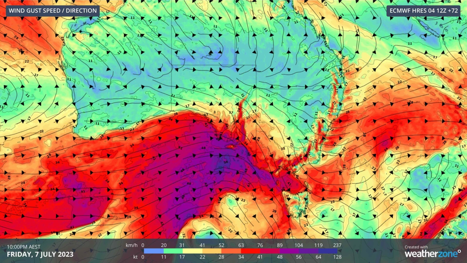
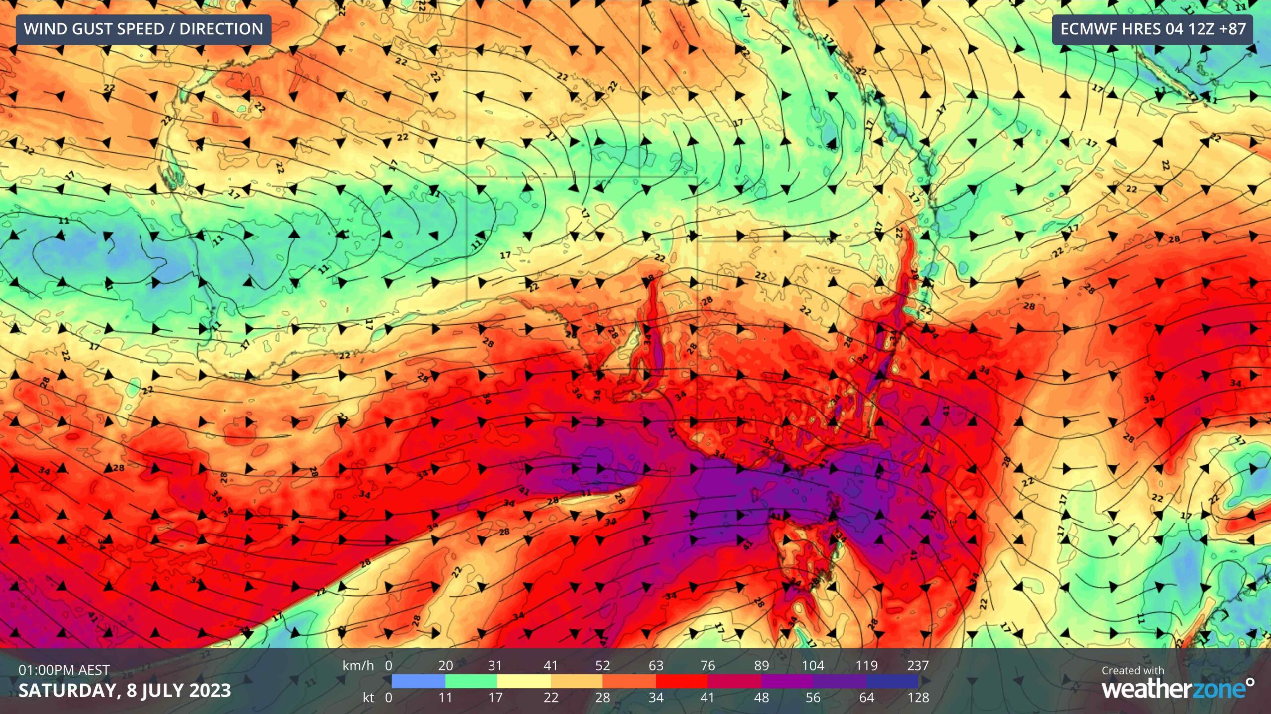
Images: Forecast wind gusts (speed and direction) at 10pm AEST Friday, July 7 (top), and 1pm AEST Saturday, July 8 (bottom), according to the ECMWF-HRES model.
Severe weather warnings are likely to be issued closer to the weekend ahead of the stronger cold front, so be sure to check the latest forecasts and warnings in your area before heading outdoors.
DTN APAC has a vast array of services available to meet the needs of any weather-exposed industry. From our Mining Blast Dispersion forecasts, Hub Height Wind forecasts, and Lightning tracking and alerting we have all your needs covered. To find out more, explore our website or email us at apac.sales@dtn.com. To find out more about our services, please email us at apac.sales@dtn.com.


