After weeks of howling winds across southeastern Australia, many places on the mainland are enjoying a brief break this Tuesday.
It won’t be totally still out there with smoke rising vertically. But put it this way: it should be possible to walk down the street without getting dust in your eyes, not to mention having to avoid trees for fear of falling branches.
Winds over the last two weeks in particular have been relentless in parts of South Australia, all of Tasmania, all of Victoria, large parts of NSW, and in the ACT.
Victoria was particularly hard hit over the weekend and into Monday, with gusts of:
- 146 km/h at Wilsons Promontory
- 141 km/h at Mount Hotham
- 141 km/h at Fawkner Beacon in Port Phillip Bay
- 113 km/h at St Kilda Harbour
These winds caused widespread power outages, with the Vic SES receiving more than 2,800 requests for assistance on Sunday night into Monday morning.
Tasmania copped winds that were equivalent to a Category-4 strength cyclone, with observations that included:
- A mean wind speed of 163km/h and a gust up to 187km/h on Saturday afternoon at Maatsuyker Island off Tassie’s southern tip
- Launceston recorded a 130km/h gust
- King Island had a 157km/h gust
- kunanyi/ Mt Wellington observed a mean wind speed of 137km/h and a gust of 172km/h on Saturday evening.
The above readings were extremes, but as mentioned, it was the persistence of the wind – not just the strength of the highest gusts – which has made the last two weeks uncomfortable and at times dangerous for residents of Australia’s most heavily populated corner.
For example:
- Over the last 10 days, Melbourne Airport saw gusts of 100 km/h on two days, with gusts of 69 km/h or stronger on all other days, except one day when the top gust was 41 km/h.
- Over the last 10 days, Sydney Airport saw a top gust of 94 km/h on one day, with gusts exceeding 50 km/h on all but two days.
- Thredbo Top Station is Australia’s highest weather station, and it is prone to persistent strong winds in any season (but especially winter). Over the last 10 days, winds exceeded 100 km/h on all but one day, when the highest gust was 91/kmh.
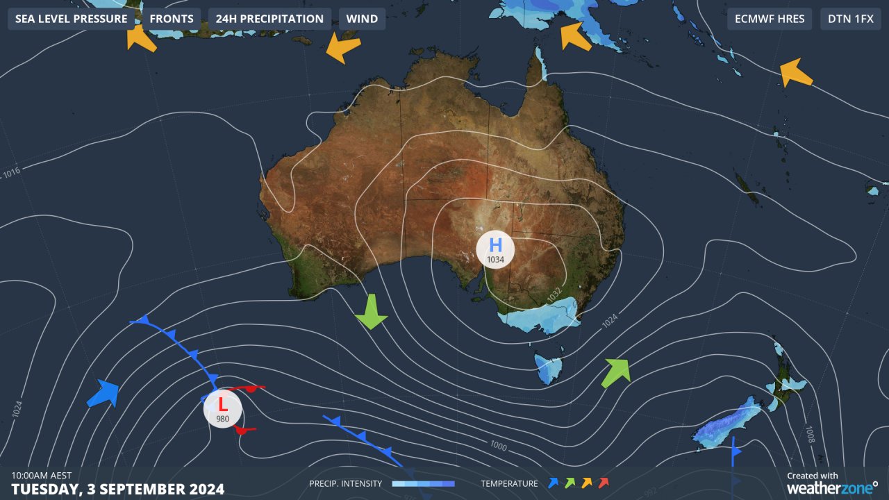
The reason winds are easing this Tuesday is because a high pressure system has established itself over the southeast, forcing those fearsome westerlies south of the mainland.
Much of Tasmania – is still very windy this Tuesday, with an early morning gust of 109 km/h recorded on the summit of kunanyi/Mt Wellington and strong winds continuing as lunchtime approaches.
As for the mainland, winds will pick up again as we move towards the latter half of the working week and temperatures will rise relatively swiftly too after the influx of very cool air which has made its way as far as Sydney and slightly further north.
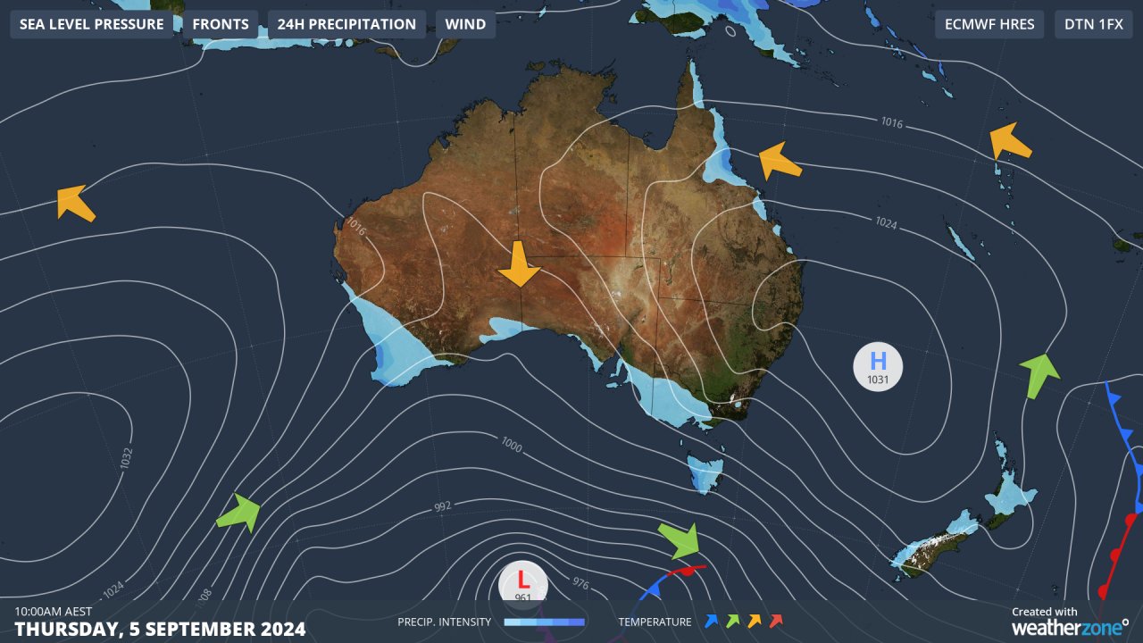
Thursday’s synoptic chart paints a very different picture to Tuesday’s, with the high pressure system moving out over the Tasman Sea and winds strengthening again driven by a strong low pressure system in the Southern Ocean.
Early spring tends to be a reliably windy time of year in in the southeast, so enjoy the brief respite if you’re lucky enough to be in a location where winds have eased today – even if the airmass is a little cool.
Utilising Opticast’s data, we provide wind power generation, operational and severe weather forecasting to improve your planning and protect your valuable staff and assets. Utilise generation forecasts for individual wind farms, state level and the NEM at daily and hourly resolution.
Weatherzone’ Total Lightning Network ensures your wind farm is protected from severe storms by an alerting system that can be configured to your exact requirements, aligning with local site needs, procedures and legislation. For more information, please visit our website or email us at apac.sales@dtn.com.


