The infamous southerly buster will move up the NSW coast on Wednesday impacting port operations in the region.
Southerly busters are an abrupt southerly change with wind gusts exceeding 54 km/h (29 knots) and a temperature drop of at least 5°C in three hours.
Sydney typically receives five busters a year, with three already occurring in 2024, with the strongest gust of 80km/h impacting Sydney airport on Sunday January 21.
The southerly buster forecast on Wednesday is moving up the coast in response to a strong cold front sweeping across the southeast in the next 48 hours.
The map below shows this cold front marching across the Bight towards SA and VIC on Tuesday morning.
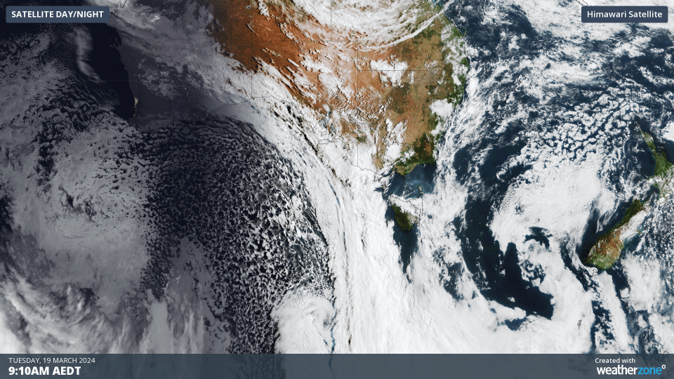
Image: Himawari-9 satellite image showing the three hours leading up to 12:10pm on Tuesday, March 19.
The satellite image above also shows a large region of speckled cloud in the Bight and Southern Ocean behind this cold front.
This broad area of speckled cloud is a tell-tale sign that a large mass of cold polar air has broken away from the Antarctic region and is venturing into the relatively warm mid-latitudes.
The leading edge of this frigid air is expected to bring the coolest airmass into NSW so far this year, with the temperature expected to drop 5-10 °C in three hours.
The southerly buster is expected to arrive in Sydney between 2:30 and 4:30pm local, with sustained winds of 46- 62 km/h (25-34 knots) and gusts of 70-89km/h (38-48 knots) forecast with this change.
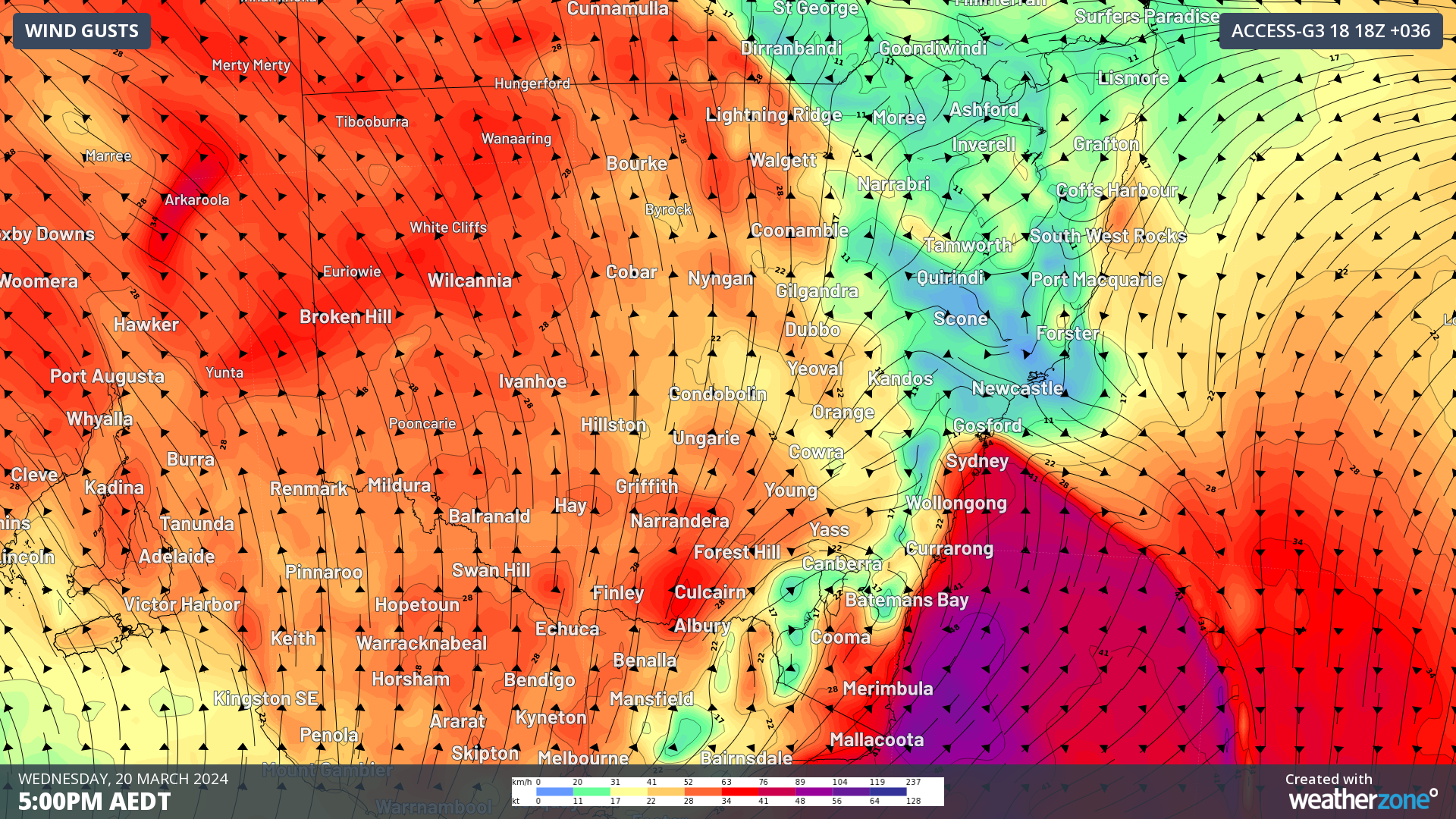
The map below shows the strong southerly wind gusts impacting the central and southern coast on Wednesday afternoon.

Image: Instantaneous wind gust forecast at 5pm AEDT on Wednesday, March 19, according to Access-G.
While winds will remain brisk on Thursday they should ease later in the day as the cold front moves further east in the Tasman Sea.
The strong southerly winds will also whip up a pulse of large swell which will move up the coast on Wednesday.
The swell is forecast to reach 3.5 metres along the Sydney coast and up to 5 metres off the South Coast.
The map below shows the large significant wave heights impacting central NSW early Thursday morning.
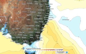
Image: Wave watch III significant wave height forecast for 2am on Thursday, March 21.
This swell will ease across southern and central NSW by Thursday evening and ease across northern NSW by Friday morning.
DTN APAC offers a comprehensive suite of services, refined through years of collaboration with the marine, ports and offshore industries, to optimise the safety and efficiency of your operations.
We work with you to understand your intrinsic operational challenges and customise high-precision forecasting, metocean and aviation services to your exact location and operational scope.
Weatherzone’s trusted nowcasting and forecasting system, OpticastTM, allows you to rapidly respond to changing conditions offshore, en route and in port. We take your port topography and berth orientation into account, ensuring site-specific forecasts.
We deliver real-time severe weather and lightning alerts to your team via your integrated dashboard: Portzone, and our Weatherguard app. For more information on our services, please contact us at apac.sales@dtn.com.


