Prosper in a dynamic world
Search

Snow season preview as snow blankets Aussie Alps

Some of Australia’s main ski resorts and Aussie Alps have been given a preview of the season ahead after a wintry cold front delivered a decent bout of snow in the last 24 hours.

A cold front swept over southeastern Australia on Wednesday causing a burst of showers and damaging winds in several states. The air behind this front was cold enough to produce snow in Australia’s highest mountains, with this morning’s satellite images revealing widespread snow across the Alps.

Snow season preview as snow blankets Aussie Alps

Snow season preview as snow blankets Aussie Alps

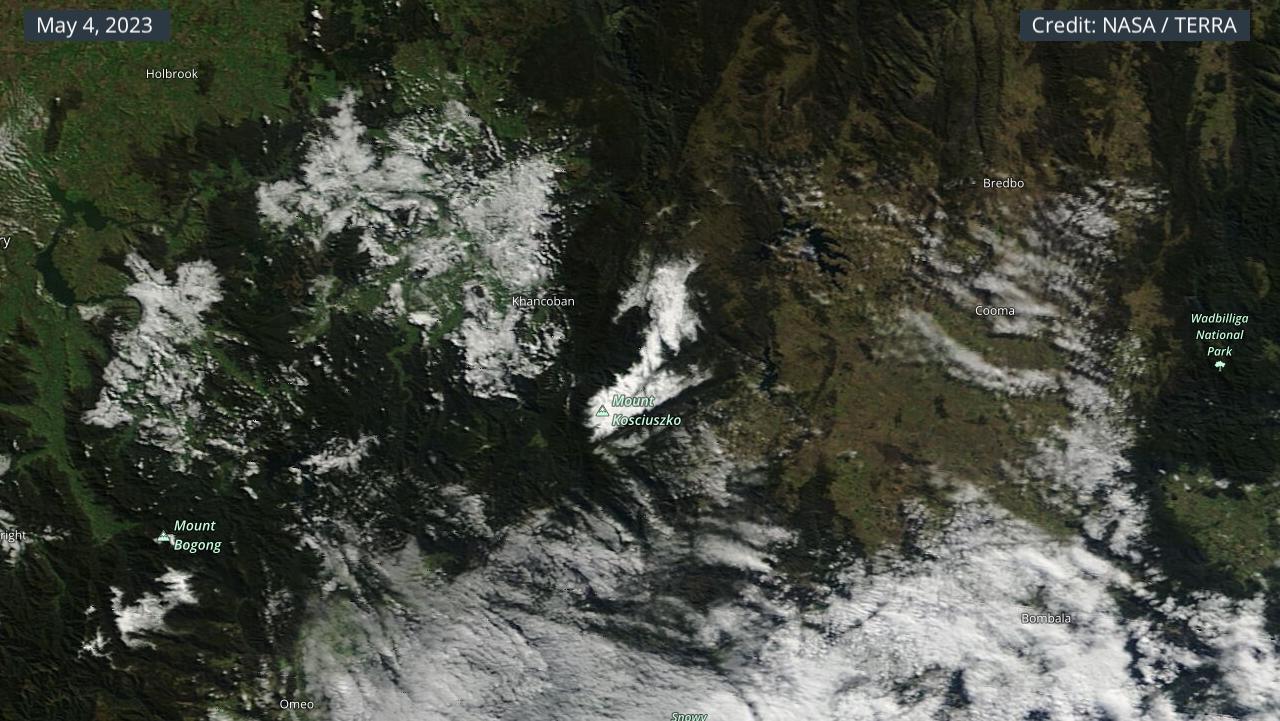
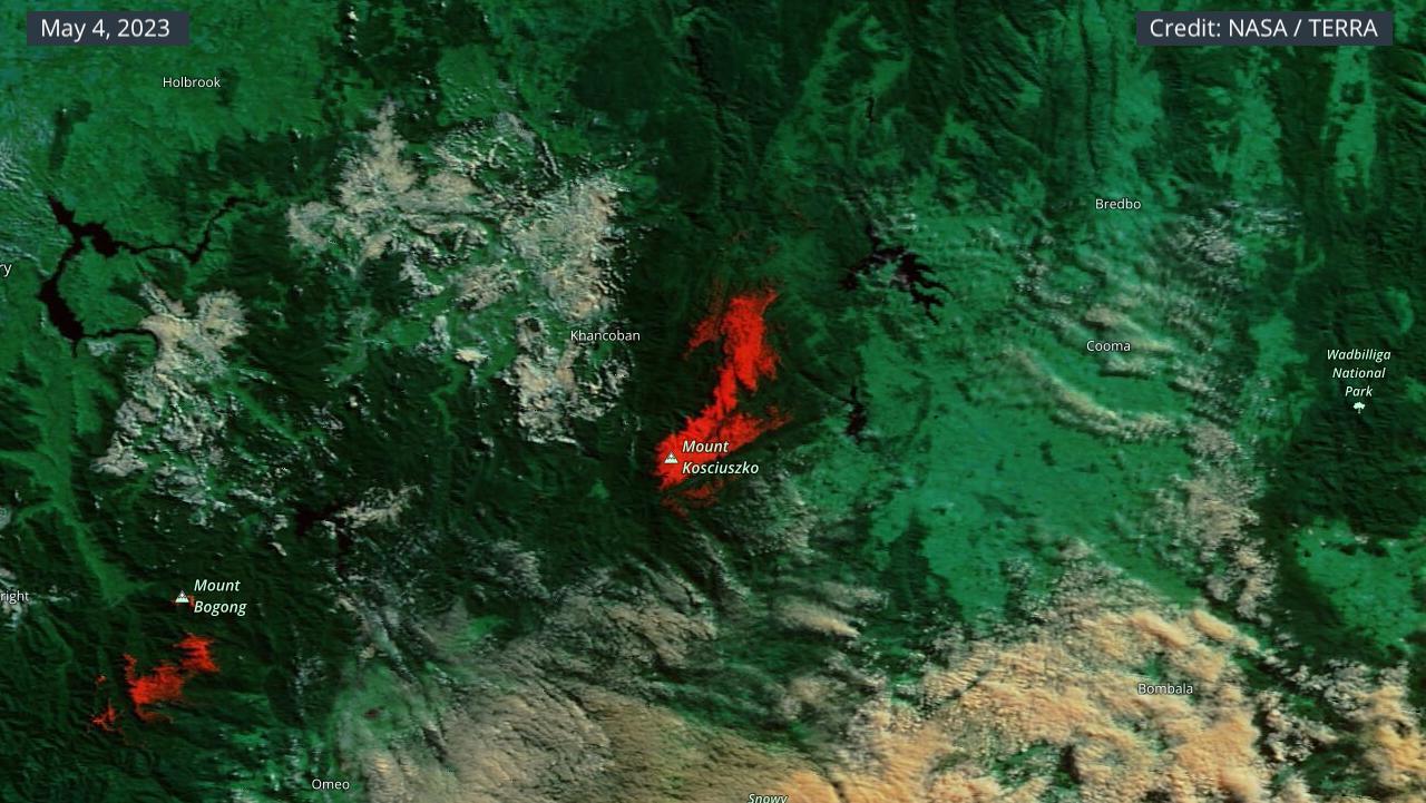
Images: Visible and enhanced (false-colour) satellite images showing snow on the Australian Alps on Thursday morning. The snow appears white in the first image and red in the second image. Credit: NASA Worldview

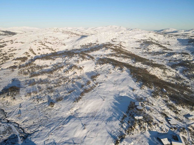
The view of the snow was even more spectacular from the ground and a sight sure to get skiers and snowboarders excited for the upcoming season.

Snow season preview as snow blankets Aussie Alps

Snow season preview as snow blankets Aussie Alps

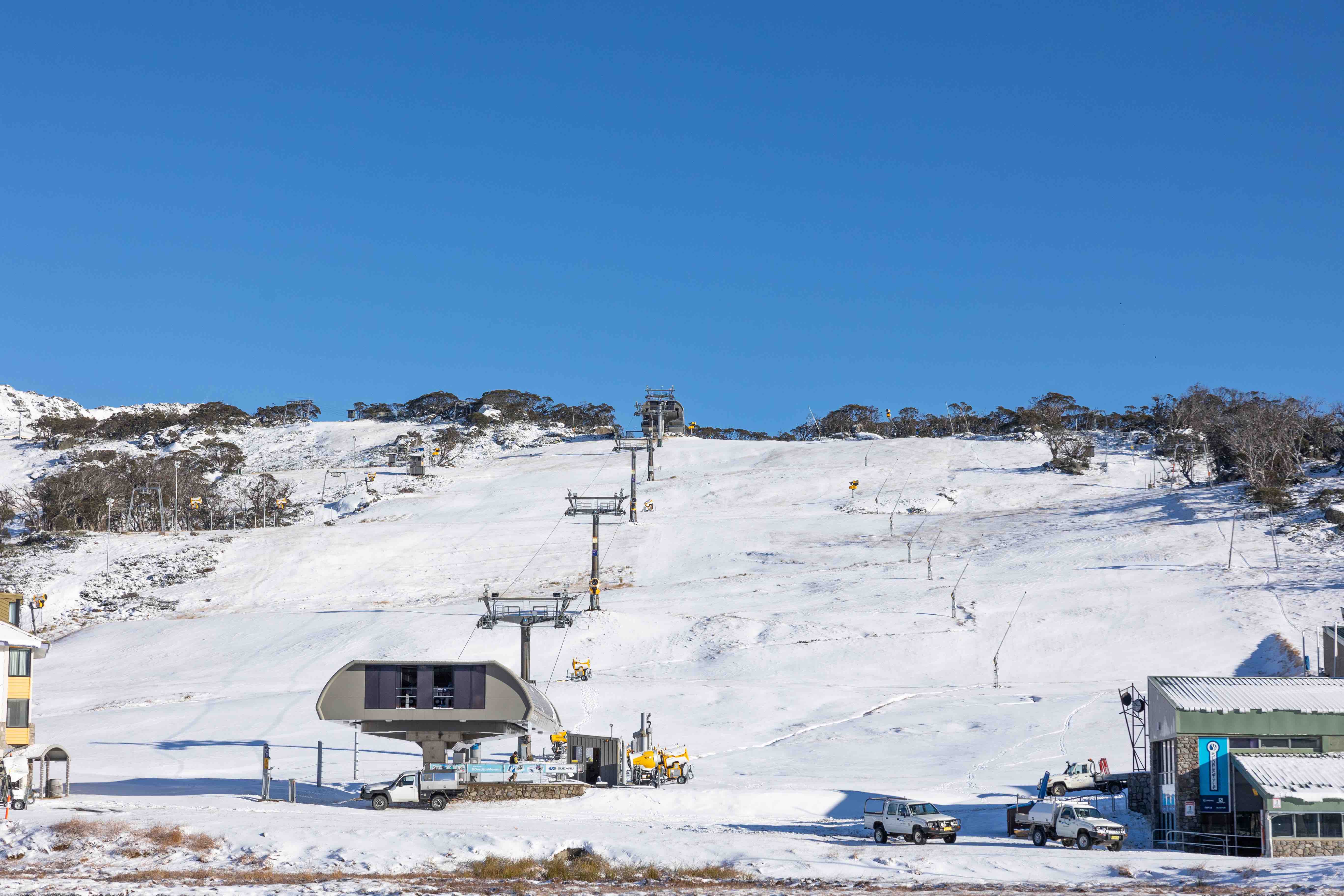
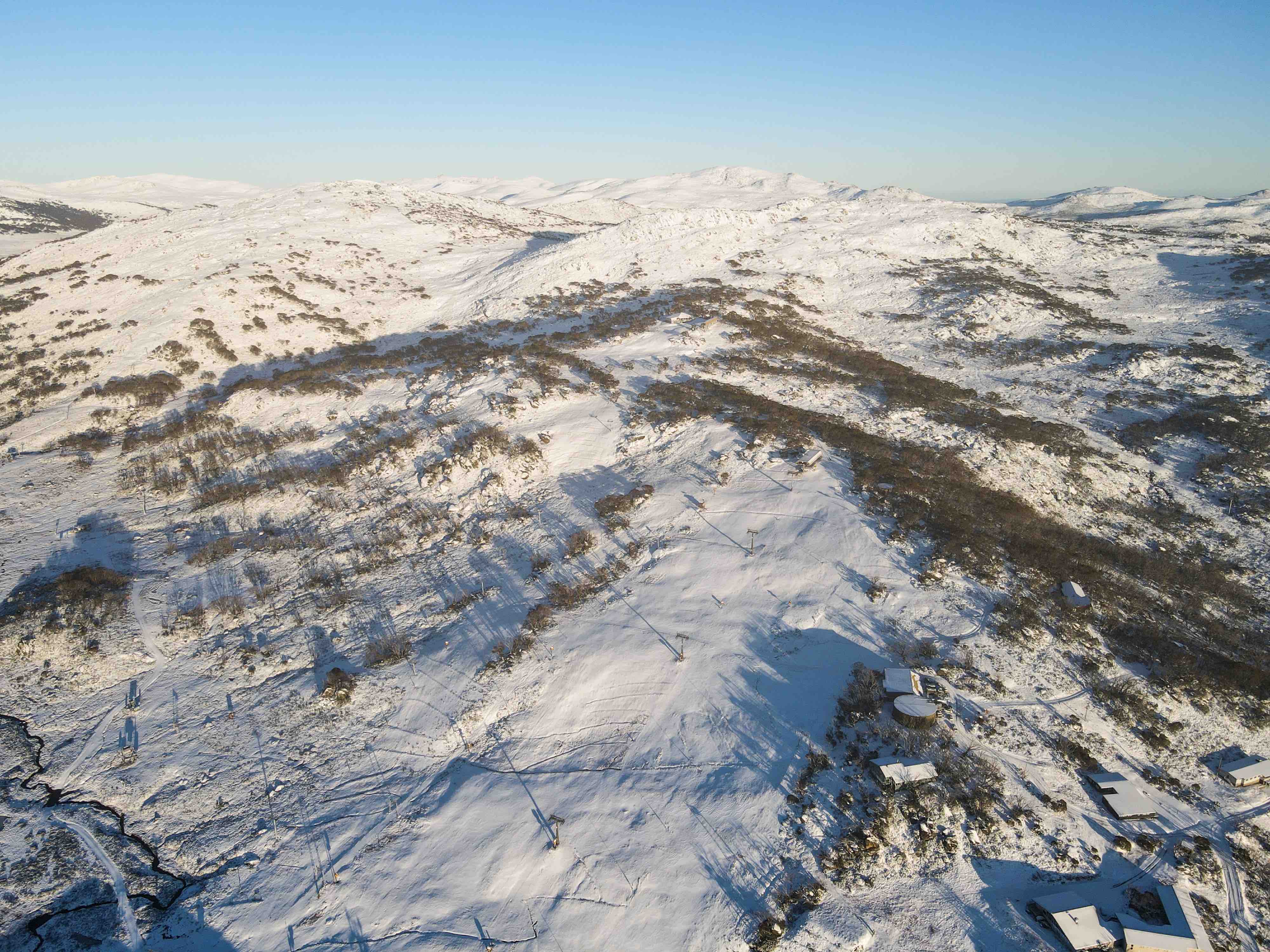
Images: Snow at Perisher Resort on Thursday, May 4, 2023. Source: Perisher Resort.

Looking ahead, another snow-bearing cold front will hit southeastern Australia this weekend, likely causing more fresh falls on both Saturday and Sunday.

While the ingredients for a good snow season are currently present over Australia, conditions may change over the coming months. DTN APAC can provide tailored climate briefings to your business to alert you of the most likely weather during the upcoming season. Now is a good time to get a good look at the forecast for winter and beyond. To find out more or to book a presentation, please email apac.sales@dtn.com.

Latest news

Satisfy your weather obsession with these news headlines from around the nation, and the world.

DTN Dangerous Thunderstorm Alerts in action with severe thunderstorms disrupting Perth industries

Severe thunderstorms impacted southwest WA and the Perth region on Sunday, December 14, 2025, triggering Dangerous Thunderstorm Alerts (DTA) by DTN for industries and businesses in the region. DTN operates Dangerous Thunderstorm Alerts (DTA) which alert businesses and industries to thunderstorms based on intensity and movement. These alerts provide advanced notice of thunderstorms moving into […]

How Australian East Coast port and maritime operations could be disrupted by tropical cyclones over the next two weeks

Port and maritime operations across Australia’s East Coast could be disrupted by increased tropical cyclone activity in the Coral Sea and southwest Pacific Ocean over the next two weeks. Meteorologists reference a large selection of Numerical Weather Prediction (NWP) models to forecast weather. A number of these NWP models are forecasting the development of tropical […]

Extreme fire danger and severe heatwave conditions spreading across SA, Victoria and NSW

Hot, dry and windy weather causing elevated fire danger and severe heatwave conditions are sweeping across southeastern Australia over the next three days, driving high energy demand and disruption to operations. Clear skies associated a large and slow-moving high pressure system have allowed hot air to build up over parts of northern, western and central […]

Heightened bushfire risk during the 2025-26 summer for WA, Victoria and NSW in latest AFAC Outlook

The Australian and New Zealand Council for fire and emergency services (AFAC) identified western and southern WA, Victoria and inland NSW as key regions that are at risk of heightened bushfire risk this summer. Parts of Australia have experienced severe soil moisture and rainfall deficiencies over the past months and years, while high fuel loads […]