There are increasing signs that a prolonged cold snap is on its way to southeastern Australia from Antarctica later this week into next.
The frigid air will be dragged from Antarctica by a cold front sweeping across the continent this weekend. A high-pressure system will quickly follow in the fronts path and remain over southern Australia until at least mid-next week, prolonging this cold outbreak.
The image below shows the frigid airmass over southeastern Australia early next week, with the southerly winds transporting it north into Qld.
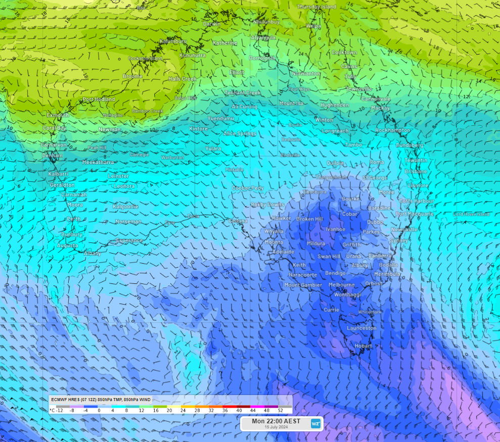
Image: 850 hPa (around 1.5km above the surface) temperature and wind forecast at 10pm AEST on Monday, July 15
The combination of this high pressure system and a low in the Tasman Sea, will direct southerly winds across southeastern Australia. This will keep temperatures 2 to 4°C below average across several states and territories for several days from late this week into next week.
These southerly winds will lead to wind chill, with temperatures feeling much colder than the actual temperature.
While this persistent cold spell should increase energy demand, the strong southerly winds should keep wind power across the National Electricity Market (NEM) elevated.
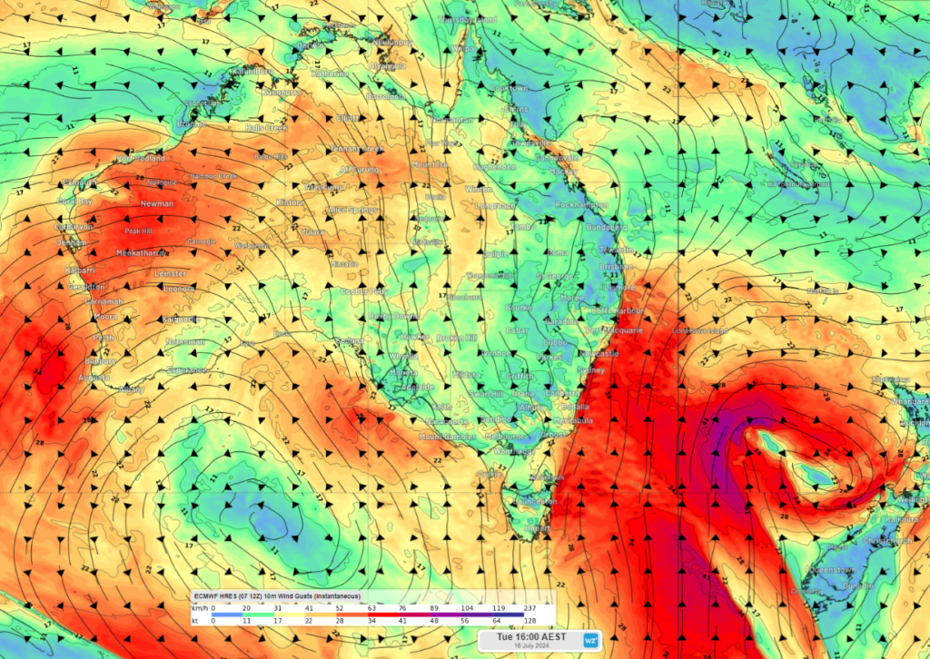
Image: Instantaneous wind gust forecast at 4pm AEST on Tuesday, July 16, according to ECMWF
As the week unfolds, we will update you with more details on the temperatures expected in the capitals.
When your renewables energy operations are affected by weather extremes, we offer solutions to keep your productivity and profits high.
Weatherzone Business, a DTN company, supplies precise weather intelligence to over 75% of the National Energy Market (NEM) participants and is the trusted provider for Australia’s Market Operator.
We offer weather data and analytics to support all aspects of your renewables business, with a wide range of specialised services covering energy generation and weather forecasting, to site-specific severe weather alerting and historical reporting.
OpticastTM
Weatherzone operates Opticast, an ultra-local forecasting system, independently proven to be the best performing of its type in Australia. Providing an unprecedented level of accuracy and precision, Opticast rapidly updates every 10 minutes, intelligently adapting to local observations, and corrects forecasts based on historical evidence. Wherever you are based, we can provide you with the most accurate nowcasting and forecasting data out to 14 days so that you can mitigate operational and safety risks, and plan to make the most of severe weather windows. To find out more, please visit our contact page or email us at apac.sales@dtn.com.